alb3453969
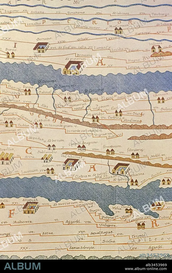
Tabula Peutingeriana or Peutinger Table. An illustrated itinerarium (ancient Roman road map) showing the layout of the road network of the Roman Empire. Painted on parchment, it is a medieval copy (13th century) of an original map of the 4th century. Detail of Italy. National Library of Vienna. Austria.
| Teilen |
|---|
 Pinterest Pinterest |
 Twitter Twitter |
 Facebook Facebook |
 Link kopieren Link kopieren |
 Email Email |
|
Zu einem anderen Lightbox hinzufügen |
|
Zu einem anderen Lightbox hinzufügen |


Haben Sie bereits ein Konto? Anmelden
Sie haben kein Konto? Registrieren
Dieses Bild kaufen

Untertitel:
Siehe automatische Übersetzung
Tabula Peutingeriana or Peutinger Table. An illustrated itinerarium (ancient Roman road map) showing the layout of the road network of the Roman Empire. Painted on parchment, it is a medieval copy (13th century) of an original map of the 4th century. Detail of Italy. National Library of Vienna. Austria.
Bildnachweis:
Album / Prisma
Freigaben (Releases):
Model: Nein - Eigentum: Nein
Rechtefragen?
Rechtefragen?
Bildgröße:
3712 x 5610 px | 59.6 MB
Druckgröße:
31.4 x 47.5 cm | 12.4 x 18.7 in (300 dpi)
Schlüsselwörter:
13. JAHRHUNDERT • 13. JH. • 4. JAHRHUNDERT • 4. JH. • BUCHROLLE • GESCHICHTE • KARTE (KARTHOGRAFIE) • KARTEN • KARTHOGRAFIE • KARTHOGRAPHIE • KARTOGRAFIE (KARTE) • KARTOGRAPHIE • KOPIE • LANDKARTE • PERGAMENT • PERIODE: ROEM. KAISERREICH • PLAN (KARTOGRAPHIE) • ROEMISCH • ROEMISCHES REICH • ROLLE • ROM • ROM, KAISERLICHES • ROULEAU D'ECRITURE • RÖMER • RÖMISCH • RÖMISCHES REICH • SCHRIFTROLLE • SCHRIFTROLLEN • STRAßE • VERVIELFAELTIGUNG • VERVIELFÄLTIGUNG • WEG • WISSENSCH.: KARTOGRAPHIE • ZEITGESCHICHTE
