alb4076471
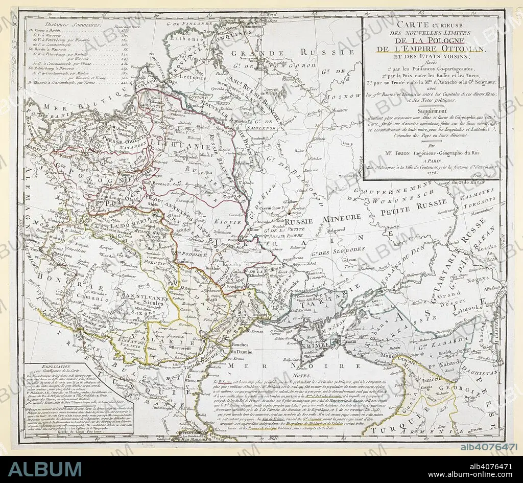
An 18th century map covering Russia; Ukraine; Poland (after the first partition); Lithuania; Tartary; Transylvania; Turkey; Hungary and surrounding territories. . Carte curieuse des nouvelles limites de la Pologne, de l'Empire Ottoman, et des EÌtats voisins, par M. Brion. 1775. Source: Maps.K.Top.110.53. Language: French.
| Teilen |
|---|
 Pinterest Pinterest |
 Twitter Twitter |
 Facebook Facebook |
 Link kopieren Link kopieren |
 Email Email |
|
Zu einem anderen Lightbox hinzufügen |
|
Zu einem anderen Lightbox hinzufügen |


Haben Sie bereits ein Konto? Anmelden
Sie haben kein Konto? Registrieren
Dieses Bild kaufen.
Nutzung auswählen:

Untertitel:
Siehe automatische Übersetzung
An 18th century map covering Russia; Ukraine; Poland (after the first partition); Lithuania; Tartary; Transylvania; Turkey; Hungary and surrounding territories. . Carte curieuse des nouvelles limites de la Pologne, de l'Empire Ottoman, et des EÌtats voisins, par M. Brion. 1775. Source: Maps.K.Top.110.53. Language: French.
Bildnachweis:
Album / British Library
Freigaben (Releases):
Bildgröße:
5901 x 5138 px | 86.7 MB
Druckgröße:
50.0 x 43.5 cm | 19.7 x 17.1 in (300 dpi)
Schlüsselwörter:
18. JAHRHUNDERT • 18. JH. • EUROPA • FARBE • FARBEN • FARBIG • KARTE (KARTHOGRAFIE) • KARTEN • KARTHOGRAFIE • KARTHOGRAPHIE • KARTOGRAFIE (KARTE) • KARTOGRAPHIE • LANDKARTE • PLAN (KARTOGRAPHIE) • POLEN • RUMAENIEN • RUMÄNIEN • TÜRKEI • UNGARN • WISSENSCH.: KARTOGRAPHIE
