alb9846826
HENDRIK DE LETH. General map of Suriname, 1737-1757. Creator: Hendrik de Leth.
| Teilen |
|---|
 Pinterest Pinterest |
 Twitter Twitter |
 Facebook Facebook |
 Link kopieren Link kopieren |
 Email Email |
|
Zu einem anderen Lightbox hinzufügen |
|
Zu einem anderen Lightbox hinzufügen |


Haben Sie bereits ein Konto? Anmelden
Sie haben kein Konto? Registrieren
Dieses Bild kaufen

Autor:
Titel:
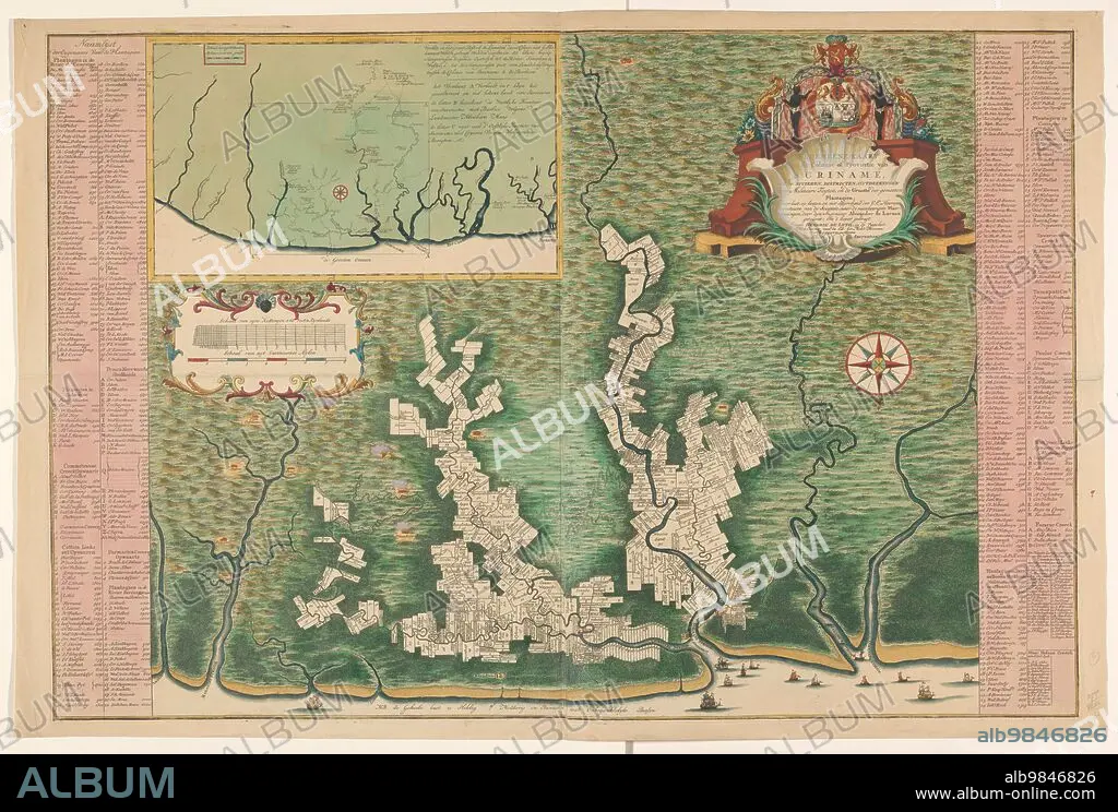
General map of Suriname, 1737-1757. Creator: Hendrik de Leth.
Untertitel:
Siehe automatische Übersetzung
General map of Suriname, 1737-1757. 'Map of the colony or province of Suriname: with the rivers, districts, discoveries by military expeditions and the size of the measured plantations / by burden'. Two sheets stuck together, showing the plantations on the various rivers. Left and right: columns with the names of the owners of the plantations, a total of 519. In the top left: map of the wider area. Left: Cartouche with the scale. At the top right: Cartouche with the title and the coat of arms of Suriname. (Surinam, also unofficially known as Dutch Guiana, was a Dutch plantation colony in South America).
Technik/Material:
RADIERUNG • engraving
Bildnachweis:
Album / Heritage Art/Heritage Images
Freigaben (Releases):
Model: Nein - Eigentum: Nein
Rechtefragen?
Rechtefragen?
Bildgröße:
8216 x 5544 px | 130.3 MB
Druckgröße:
69.6 x 46.9 cm | 27.4 x 18.5 in (300 dpi)
Schlüsselwörter:
18. JAHRHUNDERT • 18. JH. • FARBE • FARBIG • GEOGRAFIE • GEOGRAPHIE • HENDRIK DE LETH • IMPERIALISMUS • KOLONIALISMUS • KOLONIE • PLANTAGE • RADIERUNG • SUEDAMERIKA • SÜDAMERIKA
