alb5407422
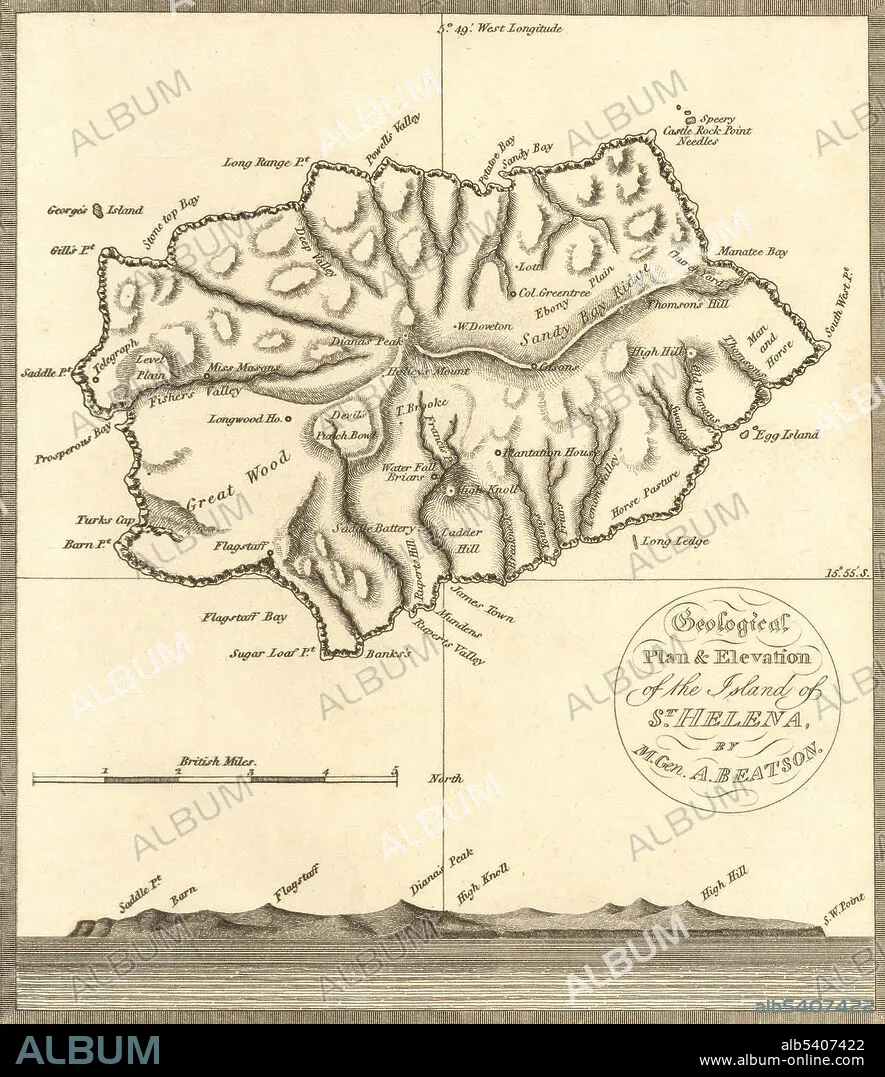
St. Helena, Map,1816
| Teilen |
|---|
 Pinterest Pinterest |
 Twitter Twitter |
 Facebook Facebook |
 Link kopieren Link kopieren |
 Email Email |
|
Zu einem anderen Lightbox hinzufügen |
|
Zu einem anderen Lightbox hinzufügen |


Haben Sie bereits ein Konto? Anmelden
Sie haben kein Konto? Registrieren
Dieses Bild kaufen

Titel:
St. Helena, Map,1816
Untertitel:
Siehe automatische Übersetzung
A map of St. Helena, the island in the middle of the South Atlantic where Napoleon Bonaparte was exiled and confined by the British from his defeat in 1815 until his death in 1821.
Persönlichkeiten:
Bildnachweis:
Album / Science Source / Wellcome Images
Freigaben (Releases):
Model: Nein - Eigentum: Nein
Rechtefragen?
Rechtefragen?
Bildgröße:
3116 x 3605 px | 32.1 MB
Druckgröße:
26.4 x 30.5 cm | 10.4 x 12.0 in (300 dpi)
Schlüsselwörter:
