alb5408981
Joan Blaeu, Ethiopia and Abyssinia Map, 17th Century
| Teilen |
|---|
 Pinterest Pinterest |
 Twitter Twitter |
 Facebook Facebook |
 Link kopieren Link kopieren |
 Email Email |
|
Zu einem anderen Lightbox hinzufügen |
|
Zu einem anderen Lightbox hinzufügen |


Haben Sie bereits ein Konto? Anmelden
Sie haben kein Konto? Registrieren
Dieses Bild kaufen

Titel:
Joan Blaeu, Ethiopia and Abyssinia Map, 17th Century
Untertitel:
Siehe automatische Übersetzung
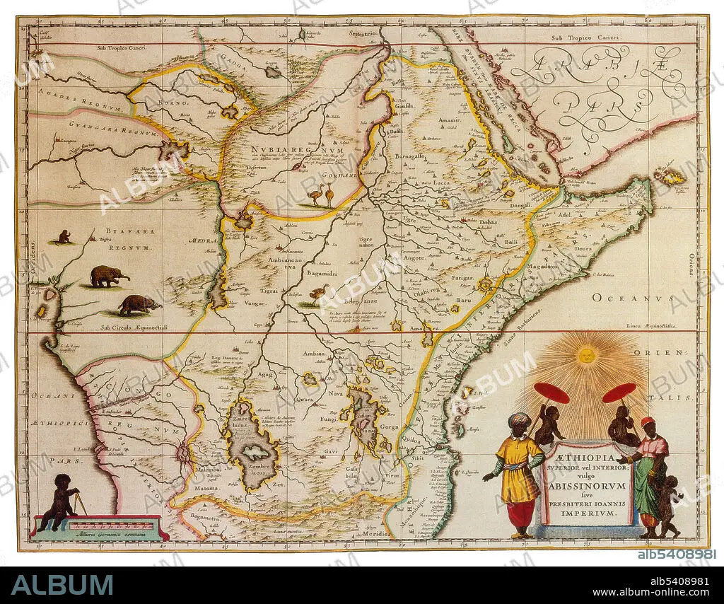
Ethiopia is a country in the Horn of Africa. It shares borders with Eritrea to the north and northeast, Djibouti and Somalia to the east, Sudan and South Sudan to the west, and Kenya to the south. Abyssinia was a kingdom that spanned a geographical area in the current state of Ethiopia. It began with the establishment of the Solomonic dynasty from approximately 1270 and lasted until 1974. Joan Blaeu (1596-1673) was a Dutch cartographer, the son of cartographer Willem Blaeu. In 1635 they published the Atlas Novus (full title: Theatrum orbis terrarum, sive, Atlas novus) in two volumes. The Atlas Maior is the final version of Joan Blaeu's atlas, published in Amsterdam between 1662 and 1672, in Latin, French, Dutch, German and Spanish, containing 594 maps and around 3,000 pages of text. The Blaeu maps emphasized fine art and colours, being the most expensive of the time.
Bildnachweis:
Album / Science Source
Freigaben (Releases):
Model: Nein - Eigentum: Nein
Rechtefragen?
Rechtefragen?
Bildgröße:
4186 x 3276 px | 39.2 MB
Druckgröße:
35.4 x 27.7 cm | 14.0 x 10.9 in (300 dpi)
Schlüsselwörter:
