alb4539461
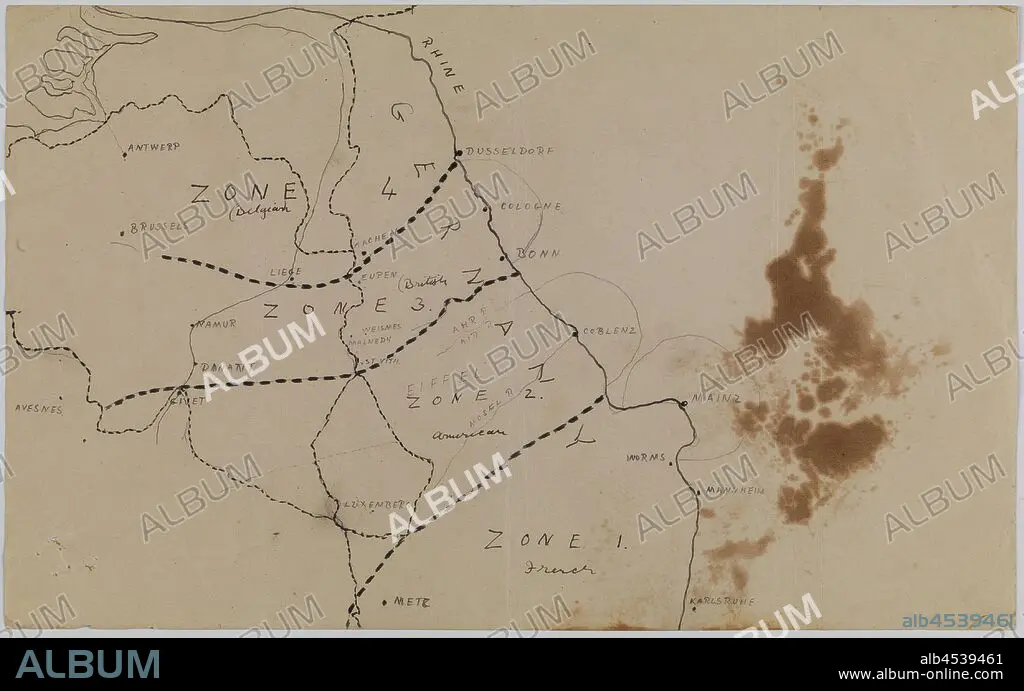
Map - Germany, Occupation Zones 1 to 4, World War I, circa 1919, Alternative Name(s): Rhineland Occupation Map Map of the occupied Rhineland in Germany after World War I, showing Zones 1 to 4 occupied by France, Belgium and American forces. According to Joachim Schröder and Alexander Watson, the ceasefire agreement from 11 November 1918 'merely provided for the Allied occupation of the left bank of the Rhine and three bridgeheads near Cologne, Mainz,.
| Teilen |
|---|
 Pinterest Pinterest |
 Twitter Twitter |
 Facebook Facebook |
 Link kopieren Link kopieren |
 Email Email |
|
Zu einem anderen Lightbox hinzufügen |
|
Zu einem anderen Lightbox hinzufügen |


Haben Sie bereits ein Konto? Anmelden
Sie haben kein Konto? Registrieren
Dieses Bild kaufen

Untertitel:
Siehe automatische Übersetzung
Map - Germany, Occupation Zones 1 to 4, World War I, circa 1919, Alternative Name(s): Rhineland Occupation Map Map of the occupied Rhineland in Germany after World War I, showing Zones 1 to 4 occupied by France, Belgium and American forces. According to Joachim Schröder and Alexander Watson, the ceasefire agreement from 11 November 1918 'merely provided for the Allied occupation of the left bank of the Rhine and three bridgeheads near Cologne, Mainz,
Bildnachweis:
Album / quintlox
Freigaben (Releases):
Model: Nein - Eigentum: Nein
Rechtefragen?
Rechtefragen?
Bildgröße:
4500 x 2802 px | 36.1 MB
Druckgröße:
38.1 x 23.7 cm | 15.0 x 9.3 in (300 dpi)
Schlüsselwörter:
