alb4076108
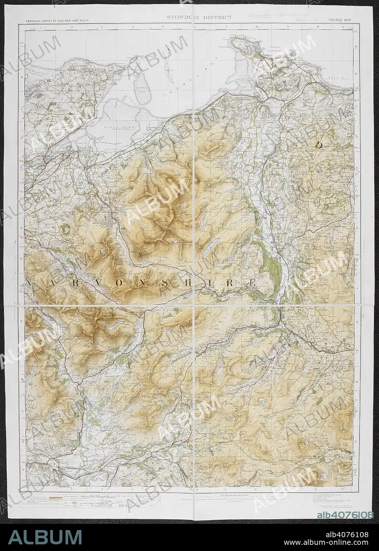
A tourist map of the Snowdon district. Ordnance Survey of England and Wales. Snowdon district. Tourist Map. Scale of one inch to one statute mile = 1 : 63,360. Southampton : Ordnance Survey Office, 1920. Source: Maps 6440.(2.). Language: English.
| Teilen |
|---|
 Pinterest Pinterest |
 Twitter Twitter |
 Facebook Facebook |
 Link kopieren Link kopieren |
 Email Email |
|
Zu einem anderen Lightbox hinzufügen |
|
Zu einem anderen Lightbox hinzufügen |


Haben Sie bereits ein Konto? Anmelden
Sie haben kein Konto? Registrieren
Dieses Bild kaufen

Untertitel:
Siehe automatische Übersetzung
A tourist map of the Snowdon district. Ordnance Survey of England and Wales. Snowdon district. Tourist Map. Scale of one inch to one statute mile = 1 : 63,360. Southampton : Ordnance Survey Office, 1920. Source: Maps 6440.(2.). Language: English.
Bildnachweis:
Album / British Library
Freigaben (Releases):
Model: Nein - Eigentum: Nein
Rechtefragen?
Rechtefragen?
Bildgröße:
5074 x 7024 px | 102.0 MB
Druckgröße:
43.0 x 59.5 cm | 16.9 x 23.4 in (300 dpi)
Schlüsselwörter:
