alb3549693
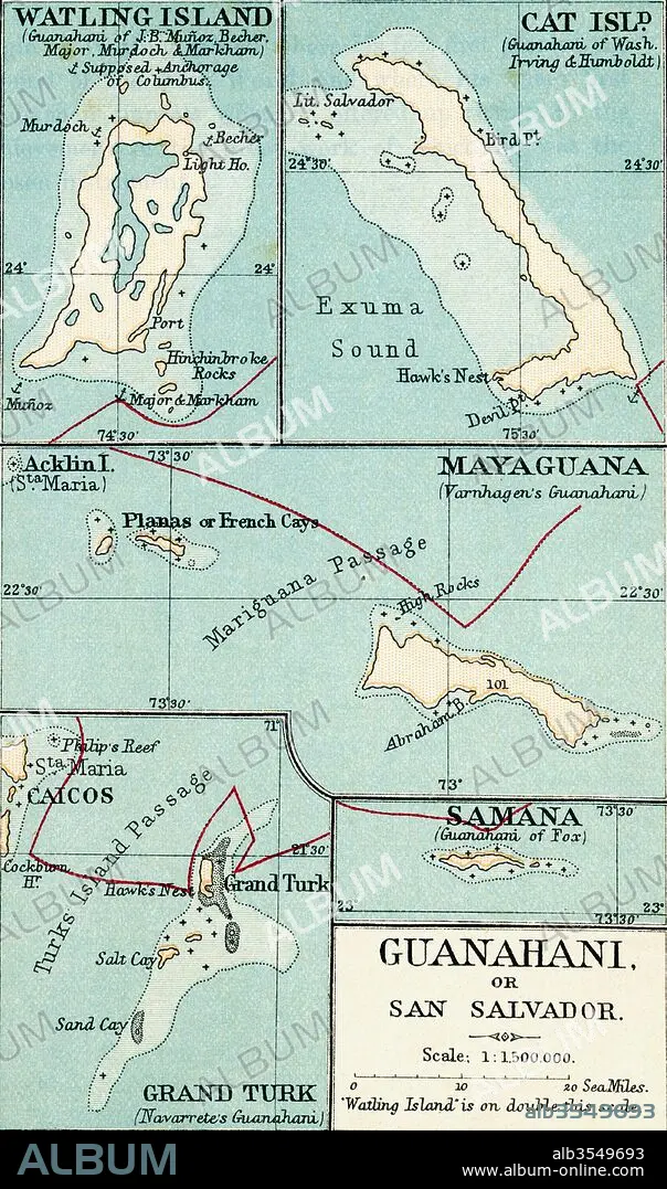
Map of Guanahani or San Salvador showing Watling Island where Christopher Columbus made landfall in 1492
| Teilen |
|---|
 Pinterest Pinterest |
 Twitter Twitter |
 Facebook Facebook |
 Link kopieren Link kopieren |
 Email Email |
|
Zu einem anderen Lightbox hinzufügen |
|
Zu einem anderen Lightbox hinzufügen |


Haben Sie bereits ein Konto? Anmelden
Sie haben kein Konto? Registrieren
Dieses Bild kaufen

Titel:
Map of Guanahani or San Salvador showing Watling Island where Christopher Columbus made landfall in 1492
Untertitel:
Siehe automatische Übersetzung
Map of Guanahani or San Salvador showing Watling Island where Christopher Columbus made landfall in 1492. From the book Life of Christopher Columbus by Clements R. Markham published 1892.
Bildnachweis:
Album / Universal Images Group / Universal History Archive
Freigaben (Releases):
Model: Nein - Eigentum: Nein
Rechtefragen?
Rechtefragen?
Bildgröße:
3220 x 5457 px | 50.3 MB
Druckgröße:
27.3 x 46.2 cm | 10.7 x 18.2 in (300 dpi)
Schlüsselwörter:
GEOGRAFIE • GEOGRAPHIE • INSEL • KARTE (KARTHOGRAFIE) • KARTE • KARTEN • KARTHOGRAFIE • KARTHOGRAPHIE • KARTOGRAFIE (KARTE) • KARTOGRAPHIE • KATZE (TIER) • KATZE • LANDKARTE • PLAN (KARTOGRAPHIE) • TIER: KATZE • TUERKISCH • TÜRKISCH • WELT • WISSENSCH.: KARTOGRAPHIE
