alb3546473
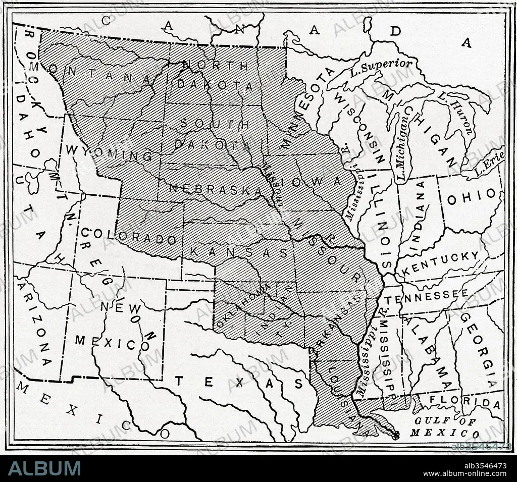
Map showing The Louisiana Purchase
| Teilen |
|---|
 Pinterest Pinterest |
 Twitter Twitter |
 Facebook Facebook |
 Link kopieren Link kopieren |
 Email Email |
|
Zu einem anderen Lightbox hinzufügen |
|
Zu einem anderen Lightbox hinzufügen |


Haben Sie bereits ein Konto? Anmelden
Sie haben kein Konto? Registrieren
Dieses Bild kaufen

Titel:
Map showing The Louisiana Purchase
Untertitel:
Siehe automatische Übersetzung
Map showing The Louisiana Purchase. The acquisition of the Louisiana territory (828,000 square miles) by the United States from France in 1803. From The History of Our Country, published 1900
Bildnachweis:
Album / Universal Images Group / Universal History Archive
Freigaben (Releases):
Model: Nein - Eigentum: Nein
Rechtefragen?
Rechtefragen?
Bildgröße:
4572 x 4026 px | 52.7 MB
Druckgröße:
38.7 x 34.1 cm | 15.2 x 13.4 in (300 dpi)
Schlüsselwörter:
AMERIKA • AMERIKA, KONTINENT • AMERIKANERIN • AMERIKANISCH (US) • AMERIKANISCH • FRANZOESISCH • FRANZOSE • FRANZÖSIN • GEOGRAFIE • GEOGRAPHIE • GESCHICHTE • ILLUSTRATION • ILLUSTRATIONS • KARTE (KARTHOGRAFIE) • KARTE • KARTEN • KARTHOGRAPHIE • KONTINENT: AMERIKA • LANDKARTE • PLAN (KARTOGRAPHIE) • US-AMERIKANISCH • USA • USA-VEREINIGE STAATEN • ZEIGEN • ZEITGESCHICHTE
