alb4076076
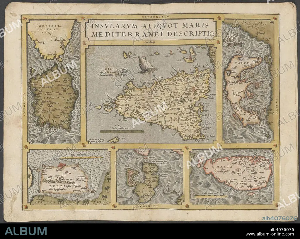
Mediterranean islands. The Mercator atlas of Europe. 1570-1572. Maps of Corsica, Sardinia, Sicily, Corfu, Elba and Malta. Image taken from The Mercator atlas of Europe. Originally published/produced in 1570-1572. . Source: Maps.C.29.c.13, 21.
| Teilen |
|---|
 Pinterest Pinterest |
 Twitter Twitter |
 Facebook Facebook |
 Link kopieren Link kopieren |
 Email Email |
|
Zu einem anderen Lightbox hinzufügen |
|
Zu einem anderen Lightbox hinzufügen |


Haben Sie bereits ein Konto? Anmelden
Sie haben kein Konto? Registrieren
Dieses Bild kaufen

Untertitel:
Siehe automatische Übersetzung
Mediterranean islands. The Mercator atlas of Europe. 1570-1572. Maps of Corsica, Sardinia, Sicily, Corfu, Elba and Malta. Image taken from The Mercator atlas of Europe. Originally published/produced in 1570-1572. . Source: Maps.C.29.c.13, 21.
Bildnachweis:
Album / British Library
Freigaben (Releases):
Model: Nein - Eigentum: Nein
Rechtefragen?
Rechtefragen?
Bildgröße:
9589 x 7128 px | 195.6 MB
Druckgröße:
81.2 x 60.4 cm | 32.0 x 23.8 in (300 dpi)
Schlüsselwörter:
