alb1649833
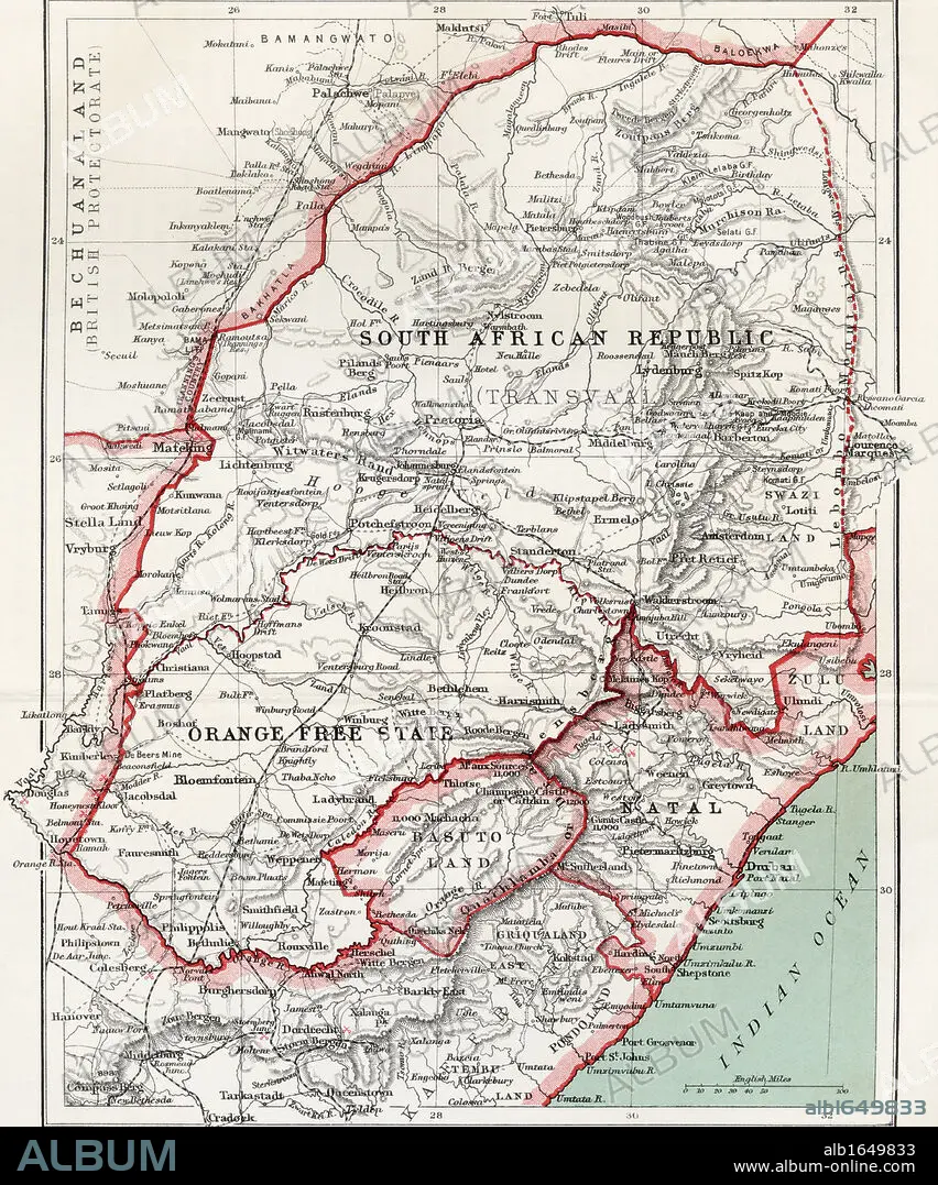
Map of South African republic, Orange Free State and Natal circa. 1900. From the book South Africa and the Transvaal War by Louis Creswicke, published 1900.
| Teilen |
|---|
 Pinterest Pinterest |
 Twitter Twitter |
 Facebook Facebook |
 Link kopieren Link kopieren |
 Email Email |
|
Zu einem anderen Lightbox hinzufügen |
|
Zu einem anderen Lightbox hinzufügen |


Haben Sie bereits ein Konto? Anmelden
Sie haben kein Konto? Registrieren
Dieses Bild kaufen

Untertitel:
Siehe automatische Übersetzung
Map of South African republic, Orange Free State and Natal circa. 1900. From the book South Africa and the Transvaal War by Louis Creswicke, published 1900.
Bildnachweis:
Album / Universal History Archive/Universal Images Group
Freigaben (Releases):
Model: Nein - Eigentum: Nein
Rechtefragen?
Rechtefragen?
Bildgröße:
4016 x 4826 px | 55.5 MB
Druckgröße:
34.0 x 40.9 cm | 13.4 x 16.1 in (300 dpi)
Schlüsselwörter:
AFRIKA • AFRIKANER • AFRIKANERIN • AFRIKANISCH • APFELSINE • FEUER, KRIEG • KARTE (KARTHOGRAFIE) • KARTEN • KARTHOGRAPHIE • KEN • KRIEG • LANDKARTE • ORANGE • PLAN (KARTOGRAPHIE) • REPUBLIK • SUEDEN • SÜDEN
