alb6092268
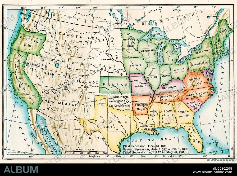
US map showing seceding states by date,
| Teilen |
|---|
 Pinterest Pinterest |
 Twitter Twitter |
 Facebook Facebook |
 Link kopieren Link kopieren |
 Email Email |
|
Zu einem anderen Lightbox hinzufügen |
|
Zu einem anderen Lightbox hinzufügen |


Haben Sie bereits ein Konto? Anmelden
Sie haben kein Konto? Registrieren
Dieses Bild kaufen

Titel:
US map showing seceding states by date,
Untertitel:
US map showing seceding states by date, American Civil War, 1860 and 1861. Printed color lithograph 19th century
Bildnachweis:
Album / akg/North Wind Picture Archives
Freigaben (Releases):
Model: Nein - Eigentum: Nein
Rechtefragen?
Rechtefragen?
Bildgröße:
3364 x 2326 px | 22.4 MB
Druckgröße:
28.5 x 19.7 cm | 11.2 x 7.8 in (300 dpi)
Schlüsselwörter:
BUERGERKRIEG • BÜRGERKRIEG • FEUER, KRIEG • FOTOGRAFIE • GESCHICHTE • ILLUSTRATION • ILLUSTRATIONS • KARTE (KARTHOGRAFIE) • KARTEN • KARTHOGRAPHIE • KRIEG • KUNST • KUNSTWERK • LANDKARTE • NORDAMERIKA • PLAN (KARTOGRAPHIE) • SUEDEN • SÜDEN • U. S. A. • USA • USA, VEREINIGTE STAATEN VON AMERIKA • VEREINIGTE STAATEN VON AMERIKA • ZEITGESCHICHTE
