alb3810254
Africa Map Areas of Slave Trade, 1850
| Teilen |
|---|
 Pinterest Pinterest |
 Twitter Twitter |
 Facebook Facebook |
 Link kopieren Link kopieren |
 Email Email |
|
Zu einem anderen Lightbox hinzufügen |
|
Zu einem anderen Lightbox hinzufügen |


Haben Sie bereits ein Konto? Anmelden
Sie haben kein Konto? Registrieren
Dieses Bild kaufen

Titel:
Africa Map Areas of Slave Trade, 1850
Untertitel:
Siehe automatische Übersetzung
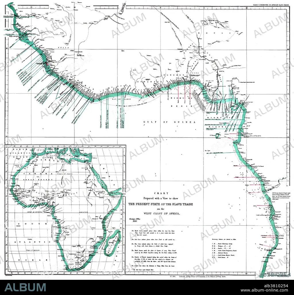
"The Present State of the Slave Trade on the West Coast of Africa," 1850. A map of the west coast of Africa showing areas of slave trade during the early 19th century. The map denotes areas of missionary work and capture of slave ships by British vessels. Inset of African continent. Created by John Arrowsmith of the Select Committee on African Slave Trade.
Bildnachweis:
Album / Science Source / Smithsonian Libraries
Freigaben (Releases):
Model: Nein - Eigentum: Nein
Rechtefragen?
Rechtefragen?
Bildgröße:
4170 x 3971 px | 47.4 MB
Druckgröße:
35.3 x 33.6 cm | 13.9 x 13.2 in (300 dpi)
Schlüsselwörter:
