alb4069688
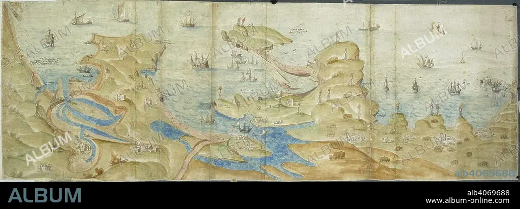
Map of Dorset coast. 1539-1540. Map of the Dorset coast from Poole to Portland and Lyme Regis, showing coastal defences, with beacons and crosses. Originally published/produced in 1539-1540. . Source: Cotton Augustus I. i. 31 and 33,.
| Teilen |
|---|
 Pinterest Pinterest |
 Twitter Twitter |
 Facebook Facebook |
 Link kopieren Link kopieren |
 Email Email |
|
Zu einem anderen Lightbox hinzufügen |
|
Zu einem anderen Lightbox hinzufügen |


Haben Sie bereits ein Konto? Anmelden
Sie haben kein Konto? Registrieren
Dieses Bild kaufen

Untertitel:
Siehe automatische Übersetzung
Map of Dorset coast. 1539-1540. Map of the Dorset coast from Poole to Portland and Lyme Regis, showing coastal defences, with beacons and crosses. Originally published/produced in 1539-1540. . Source: Cotton Augustus I. i. 31 and 33,.
Bildnachweis:
Album / British Library
Freigaben (Releases):
Model: Nein - Eigentum: Nein
Rechtefragen?
Rechtefragen?
Bildgröße:
6932 x 2428 px | 48.2 MB
Druckgröße:
58.7 x 20.6 cm | 23.1 x 8.1 in (300 dpi)
Schlüsselwörter:
