alb4090842
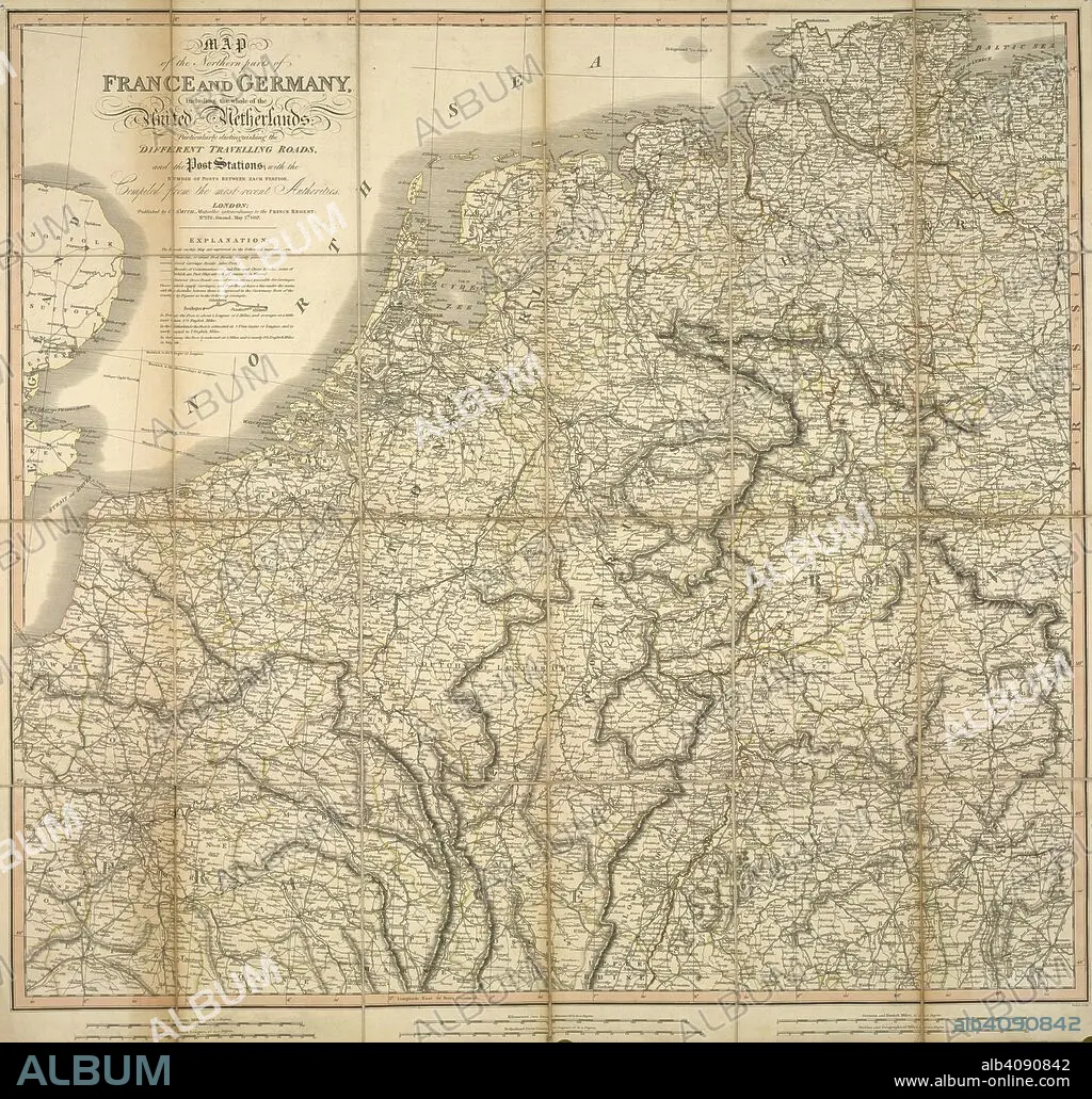
A map of the northern parts of France and Germany, including the whole of the United Netherlands. Map of the northern parts of France and Germany, including the whole of the United Netherlands, particularly distinguishing the different travelling roads...compiled from the most recent authorities. London : Published by C. Smith, Mapseller extraordinary to the Prince Regent, Nº. 172 Strand,, May 1st 1817. Source: Maps CC.5.a.207. Language: English.
| Teilen |
|---|
 Pinterest Pinterest |
 Twitter Twitter |
 Facebook Facebook |
 Link kopieren Link kopieren |
 Email Email |
|
Zu einem anderen Lightbox hinzufügen |
|
Zu einem anderen Lightbox hinzufügen |


Haben Sie bereits ein Konto? Anmelden
Sie haben kein Konto? Registrieren
Dieses Bild kaufen.
Nutzung auswählen:

Untertitel: Siehe automatische Übersetzung
A map of the northern parts of France and Germany, including the whole of the United Netherlands. Map of the northern parts of France and Germany, including the whole of the United Netherlands, particularly distinguishing the different travelling roads...compiled from the most recent authorities. London : Published by C. Smith, Mapseller extraordinary to the Prince Regent, Nº. 172 Strand,, May 1st 1817. Source: Maps CC.5.a.207. Language: English.
A map of the northern parts of France and Germany, including the whole of the United Netherlands. Map of the northern parts of France and Germany, including the whole of the United Netherlands, particularly distinguishing the different travelling roads...compiled from the most recent authorities. London : Published by C. Smith, Mapseller extraordinary to the Prince Regent, Nº. 172 Strand,, May 1st 1817. Source: Maps CC.5.a.207. Language: English.
Bildnachweis: Album / British Library
Freigaben (Releases): ? Modellfreigabe: Nein - ? Eigentumsfreigabe: Nein
Rechtefragen?
Rechtefragen?
Bildgröße: 4890 × 4671 px | 65.3 MB
Druckgröße: 41.4 × 39.5 cm | 1925.2 × 1839.0 in (300 dpi)
Schlüsselwörter: DEUTSCHLAND • EUROPA • HOLLAND • KARTE (KARTHOGRAFIE) • KARTEN • KARTHOGRAFIE • KARTHOGRAPHIE • KARTOGRAFIE (KARTE) • KARTOGRAPHIE • LANDKARTE • PLAN (KARTOGRAPHIE) • WISSENSCH.: KARTOGRAPHIE
