alb4080465
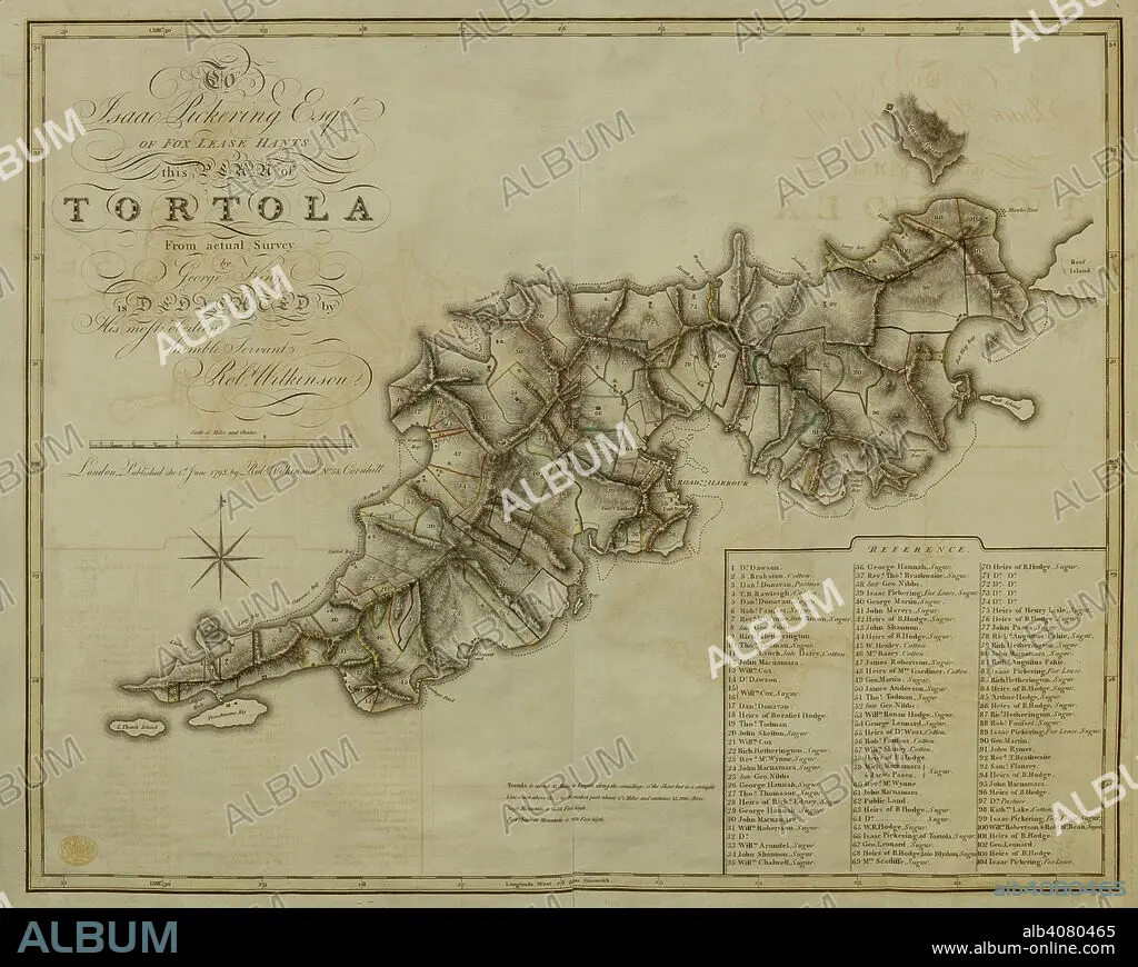
A plan of the Island of Tortola . A Plan of the Island of Tortola from actual Survey. Wilkinson, 1798. Source: Maps K.Top.123.72. Language: English.
| Teilen |
|---|
 Pinterest Pinterest |
 Twitter Twitter |
 Facebook Facebook |
 Link kopieren Link kopieren |
 Email Email |
|
Zu einem anderen Lightbox hinzufügen |
|
Zu einem anderen Lightbox hinzufügen |


Haben Sie bereits ein Konto? Anmelden
Sie haben kein Konto? Registrieren
Dieses Bild kaufen

Untertitel:
Siehe automatische Übersetzung
A plan of the Island of Tortola . A Plan of the Island of Tortola from actual Survey. Wilkinson, 1798. Source: Maps K.Top.123.72. Language: English.
Persönlichkeiten:
Bildnachweis:
Album / British Library
Freigaben (Releases):
Model: Nein - Eigentum: Nein
Rechtefragen?
Rechtefragen?
Bildgröße:
7535 x 6012 px | 129.6 MB
Druckgröße:
63.8 x 50.9 cm | 25.1 x 20.0 in (300 dpi)
Schlüsselwörter:
18. JAHRHUNDERT • 18. JH. • ATLANTIK • ATLANTISCHER OZEAN • DOKUMENT • INSEL • KARIBIK • KARIBISCHES MEER • PLAN
