alb1648613
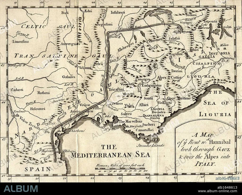
A map of the route Hannibal took through Gaul and over the Alps into Italy.
| Teilen |
|---|
 Pinterest Pinterest |
 Twitter Twitter |
 Facebook Facebook |
 Link kopieren Link kopieren |
 Email Email |
|
Zu einem anderen Lightbox hinzufügen |
|
Zu einem anderen Lightbox hinzufügen |


Haben Sie bereits ein Konto? Anmelden
Sie haben kein Konto? Registrieren
Dieses Bild kaufen

Untertitel:
Siehe automatische Übersetzung
A map of the route Hannibal took through Gaul and over the Alps into Italy
Bildnachweis:
Album / Universal Images Group / Universal History Archive
Freigaben (Releases):
Model: Nein - Eigentum: Nein
Rechtefragen?
Rechtefragen?
Bildgröße:
5298 x 3988 px | 60.4 MB
Druckgröße:
44.9 x 33.8 cm | 17.7 x 13.3 in (300 dpi)
Schlüsselwörter:
ALPEN • GEOGRAFIE • GEOGRAPHIE • HANNIBAL • HORIZONTALE • ILLUSTRATION • ILLUSTRATIONS • ITALIEN • KARTE (KARTHOGRAFIE) • KARTEN • KARTHOGRAFIE • KARTHOGRAPHIE • KARTOGRAFIE (KARTE) • KARTOGRAPHIE • KEN • LANDKARTE • PLAN (KARTOGRAPHIE) • SCHWARZ UND WEISS • SCHWARZ-WEIß • SCHWARZWEISS • WISSENSCH.: KARTOGRAPHIE
