alb9432599
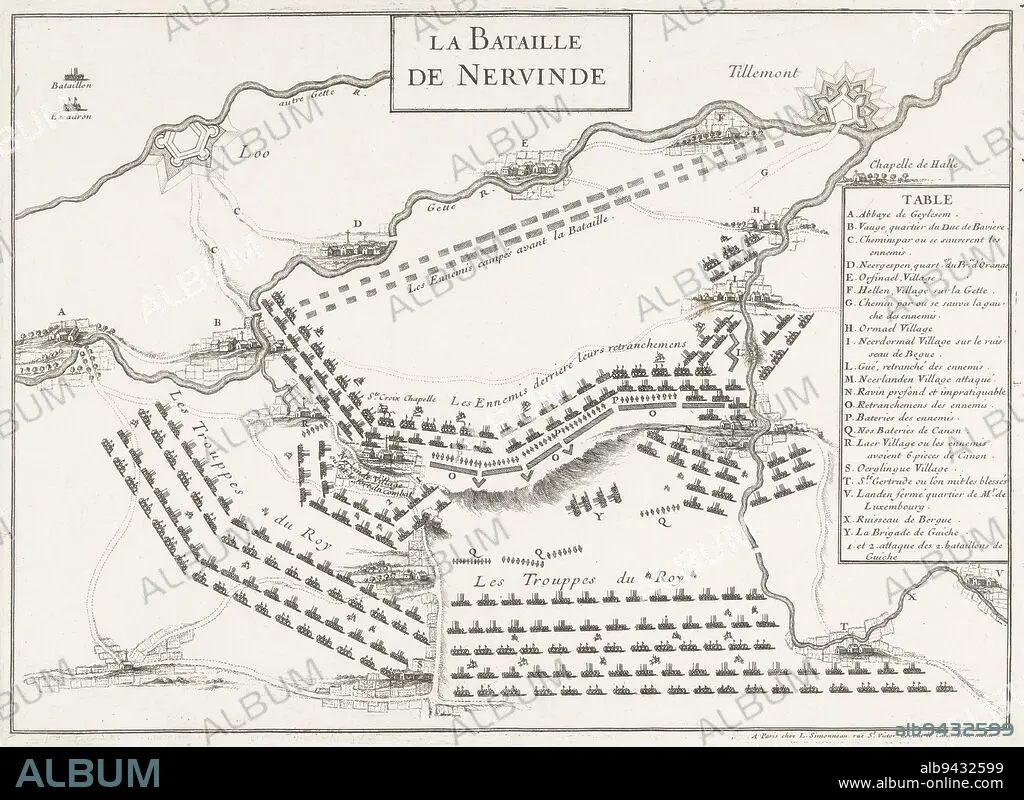
Map of the battle at Landen (Neerwinden) between the Allies under King William III and the French under the Duke of Luxembourg, 29 July 1693. On the right the legend A-Y in French. Map of the battle of Landen, 1693 La Bataille de Neervinde , print maker: anonymous, publisher: Louis Simonneau, (mentioned on object), print maker: France, publisher: Paris, 1693, paper, etching, h 241 mm × w 333 mm.
| Teilen |
|---|
 Pinterest Pinterest |
 Twitter Twitter |
 Facebook Facebook |
 Link kopieren Link kopieren |
 Email Email |
|
Zu einem anderen Lightbox hinzufügen |
|
Zu einem anderen Lightbox hinzufügen |


Haben Sie bereits ein Konto? Anmelden
Sie haben kein Konto? Registrieren
Dieses Bild kaufen

Untertitel:
Siehe automatische Übersetzung
Map of the battle at Landen (Neerwinden) between the Allies under King William III and the French under the Duke of Luxembourg, 29 July 1693. On the right the legend A-Y in French. Map of the battle of Landen, 1693 La Bataille de Neervinde , print maker: anonymous, publisher: Louis Simonneau, (mentioned on object), print maker: France, publisher: Paris, 1693, paper, etching, h 241 mm × w 333 mm
Bildnachweis:
Album / quintlox
Freigaben (Releases):
Model: Nein - Eigentum: Nein
Rechtefragen?
Rechtefragen?
Bildgröße:
4951 x 3612 px | 51.2 MB
Druckgröße:
41.9 x 30.6 cm | 16.5 x 12.0 in (300 dpi)
Schlüsselwörter:
ANONYME • FRANZOESISCH • FRANZOSE • FRANZÖSIN • HERZOG • KARTE (KARTHOGRAFIE) • KARTEN • KARTHOGRAPHIE • LANDKARTE • LUXEMBURG • OBJEKT • PAPIER • PARIS • PARIS, FRANKREICH • PLAN (KARTOGRAPHIE) • SCHLACHT VON BORODINO • SCHLACHT
