alb3548564
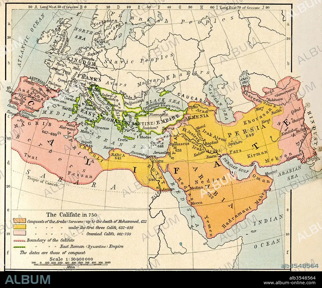
Map of the Muslim expansion and the Byzantine Empire at the end of the Umayyad Caliphate, in 750
| Teilen |
|---|
 Pinterest Pinterest |
 Twitter Twitter |
 Facebook Facebook |
 Link kopieren Link kopieren |
 Email Email |
|
Zu einem anderen Lightbox hinzufügen |
|
Zu einem anderen Lightbox hinzufügen |


Haben Sie bereits ein Konto? Anmelden
Sie haben kein Konto? Registrieren
Dieses Bild kaufen

Titel:
Map of the Muslim expansion and the Byzantine Empire at the end of the Umayyad Caliphate, in 750
Untertitel:
Siehe automatische Übersetzung
Map of the Muslim expansion and the Byzantine Empire at the end of the Umayyad Caliphate, in 750. From Historical Atlas, published 1923.
Bildnachweis:
Album / Universal Images Group / Universal History Archive
Freigaben (Releases):
Model: Nein - Eigentum: Nein
Rechtefragen?
Rechtefragen?
Bildgröße:
4724 x 3982 px | 53.8 MB
Druckgröße:
40.0 x 33.7 cm | 15.7 x 13.3 in (300 dpi)
Schlüsselwörter:
8. JAHRHUNDERT • 8. JH. • BYZANTINISCH • GEOGRAFIE • GEOGRAPHIE • GESCHICHTE • KARTE (KARTHOGRAFIE) • KARTE • KARTEN • KARTHOGRAPHIE • LAENDER • LANDKARTE • LÄNDER • MOHAMMEDANER • MOSLEM • MUSLIM • PLAN (KARTOGRAPHIE) • ZEITGESCHICHTE
