alb9380460
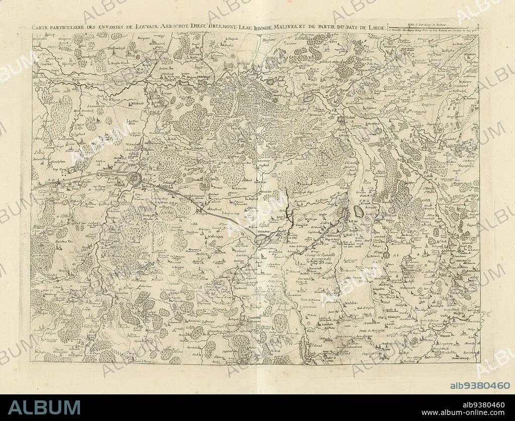
Map of Brabant, 1706, Carte particuliere des environs de Louvain, Aerschot, Diest, Tirlemont, Leau, Judogne, Malines, et de partie du Pays de Liege (title on object), Map of part of Flemish Brabant with the towns of Leuven, Aarschot, Diest, Tienen, Zoutleeuw, Jodoigne, Mechelen and part of the country of Liege, 1706. Part of a bundled collection of plans of battles and cities renowned in the War of the Spanish Succession. This plate is among the first 24 plates that make up a very large map of the Southern Netherlands., print maker: Jacobus Harrewijn (attributed to), publisher: Eugene Henry Fricx (mentioned on object), Brussels, 1706, paper, etching, engraving, height 432 mm × width 568 mm.
| Teilen |
|---|
 Pinterest Pinterest |
 Twitter Twitter |
 Facebook Facebook |
 Link kopieren Link kopieren |
 Email Email |
|
Zu einem anderen Lightbox hinzufügen |
|
Zu einem anderen Lightbox hinzufügen |


Haben Sie bereits ein Konto? Anmelden
Sie haben kein Konto? Registrieren
Dieses Bild kaufen

Untertitel:
Siehe automatische Übersetzung
Map of Brabant, 1706, Carte particuliere des environs de Louvain, Aerschot, Diest, Tirlemont, Leau, Judogne, Malines, et de partie du Pays de Liege (title on object), Map of part of Flemish Brabant with the towns of Leuven, Aarschot, Diest, Tienen, Zoutleeuw, Jodoigne, Mechelen and part of the country of Liege, 1706. Part of a bundled collection of plans of battles and cities renowned in the War of the Spanish Succession. This plate is among the first 24 plates that make up a very large map of the Southern Netherlands., print maker: Jacobus Harrewijn (attributed to), publisher: Eugene Henry Fricx (mentioned on object), Brussels, 1706, paper, etching, engraving, height 432 mm × width 568 mm
Persönlichkeiten:
Bildnachweis:
Album / quintlox
Freigaben (Releases):
Model: Nein - Eigentum: Nein
Rechtefragen?
Rechtefragen?
Bildgröße:
4944 x 3790 px | 53.6 MB
Druckgröße:
41.9 x 32.1 cm | 16.5 x 12.6 in (300 dpi)
Schlüsselwörter:
