alb4314029
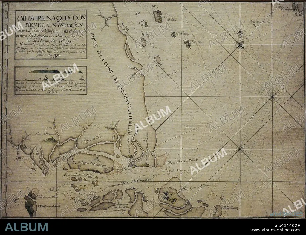
Chart of the Singapore Strait, 1778. It is a representation of Singapore with the name of "Island and Kingdom of Sincapura", as an independent realm prior to British colonisation. It includes an elevation plan of Viola Island, identified as "Island of Vandurria", the earliest known depiction of this land in a Spanish document. Naval Museum. Madrid. Spain.
| Teilen |
|---|
 Pinterest Pinterest |
 Twitter Twitter |
 Facebook Facebook |
 Link kopieren Link kopieren |
 Email Email |
|
Zu einem anderen Lightbox hinzufügen |
|
Zu einem anderen Lightbox hinzufügen |


Haben Sie bereits ein Konto? Anmelden
Sie haben kein Konto? Registrieren
Dieses Bild kaufen

Untertitel:
Siehe automatische Übersetzung
Chart of the Singapore Strait, 1778. It is a representation of Singapore with the name of "Island and Kingdom of Sincapura", as an independent realm prior to British colonisation. It includes an elevation plan of Viola Island, identified as "Island of Vandurria", the earliest known depiction of this land in a Spanish document. Naval Museum. Madrid. Spain.
Bildnachweis:
Album / Prisma
Freigaben (Releases):
Model: Nein - Eigentum: Nein
Rechtefragen?
Rechtefragen?
Bildgröße:
4016 x 2874 px | 33.0 MB
Druckgröße:
34.0 x 24.3 cm | 13.4 x 9.6 in (300 dpi)
Schlüsselwörter:
18. JAHRHUNDERT • 18. JH. • ASIEN • ASIEN, KONTINENT • GEOGRAFIE • GEOGRAPHIE • GESCHICHTE • INSEL • KARTE (KARTHOGRAFIE) • KARTEN • KARTHOGRAFIE • KARTHOGRAPHIE • KARTOGRAFIE (KARTE) • KARTOGRAPHIE • KOMPASSROSE • KONTINENT, ASIEN • KUESTE • KÜSTE • LANDKARTE • MARITIM • MEER • MEERE • MEERENGE • MUSEEN • MUSEUM • NAVEGATION • NAVIGATION • OZEAN • PLAN (KARTOGRAPHIE) • SCHIFFAHRT • SCHIFFFAHRT • SEA • SEESTUECK (GEMAELDE) • WINDROSE • WISSENSCH.: KARTOGRAPHIE • ZEITGESCHICHTE
