alb9055670
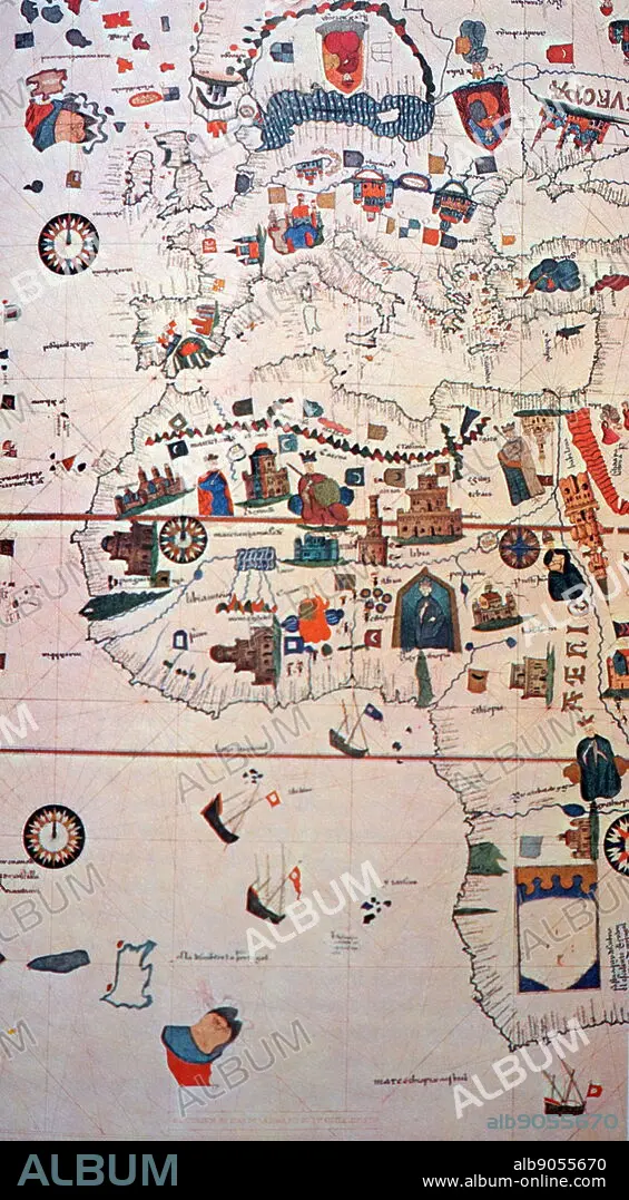
16th Century map depicting Africa and the Mediterranean Basin by Juan de la Cosa
| Teilen |
|---|
 Pinterest Pinterest |
 Twitter Twitter |
 Facebook Facebook |
 Link kopieren Link kopieren |
 Email Email |
|
Zu einem anderen Lightbox hinzufügen |
|
Zu einem anderen Lightbox hinzufügen |


Haben Sie bereits ein Konto? Anmelden
Sie haben kein Konto? Registrieren
Dieses Bild kaufen

Titel:
16th Century map depicting Africa and the Mediterranean Basin by Juan de la Cosa
Untertitel:
Siehe automatische Übersetzung
16th Century map depicting Africa and the Mediterranean Basin by Juan de la Cosa. Juan de la Cosa (1450-1510) a Spanish navigator and cartographer, known for designing the earliest European world map that incorporated the territories of the Americas that were discovered during the 15th Century. Dated 15th Century
Bildnachweis:
Album / World History Archive
Freigaben (Releases):
Model: Nein - Eigentum: Nein
Rechtefragen?
Rechtefragen?
Bildgröße:
3402 x 6165 px | 60.0 MB
Druckgröße:
28.8 x 52.2 cm | 11.3 x 20.6 in (300 dpi)
Schlüsselwörter:
AFRIKA • EUROPAEER (F M) • EUROPAEER • EUROPÄER (F M) • EUROPÄER • EUROPÄISCH • GEOGRAFIE • GEOGRAPHIE • GLOBUS • KARTHOGRAFIE • KARTOGRAFIE (KARTE) • KARTOGRAPH • KARTOGRAPHIE • NAVIGATOR • SPANIEN • WELT • WELTKARTE • WELTKUGEL • WISSENSCH.: KARTOGRAPHIE
