alb5411376
Greenwood District, Tulsa, Oklahoma
| Teilen |
|---|
 Pinterest Pinterest |
 Twitter Twitter |
 Facebook Facebook |
 Link kopieren Link kopieren |
 Email Email |
|
Zu einem anderen Lightbox hinzufügen |
|
Zu einem anderen Lightbox hinzufügen |


Haben Sie bereits ein Konto? Anmelden
Sie haben kein Konto? Registrieren
Dieses Bild kaufen

Titel:
Greenwood District, Tulsa, Oklahoma
Untertitel:
Siehe automatische Übersetzung
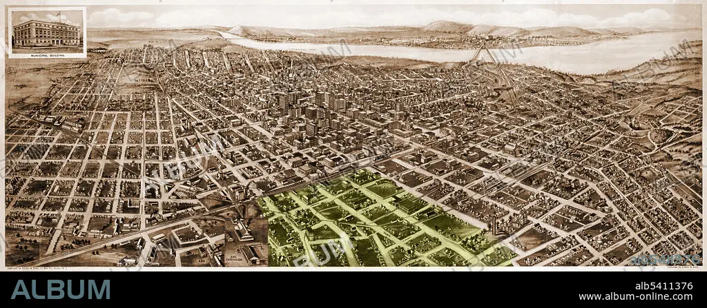
Map of Tulsa, Oklahoma, in 1918, looking south, with the Greenwood District, known as Black Wall Street, highlighted in green. (The area extends off the map.) The Tulsa Race Massacre of 1921 completely destroyed this prosperous Black area of town.
Bildnachweis:
Album / Science Source
Freigaben (Releases):
Model: Nein - Eigentum: Nein
Rechtefragen?
Rechtefragen?
Bildgröße:
8400 x 3232 px | 77.7 MB
Druckgröße:
71.1 x 27.4 cm | 28.0 x 10.8 in (300 dpi)
Schlüsselwörter:
