alb3547855
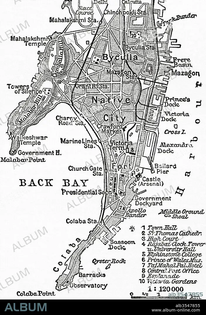
Map of Bombay, India, circa 1920
| Teilen |
|---|
 Pinterest Pinterest |
 Twitter Twitter |
 Facebook Facebook |
 Link kopieren Link kopieren |
 Email Email |
|
Zu einem anderen Lightbox hinzufügen |
|
Zu einem anderen Lightbox hinzufügen |


Haben Sie bereits ein Konto? Anmelden
Sie haben kein Konto? Registrieren
Dieses Bild kaufen

Titel:
Map of Bombay, India, circa 1920
Untertitel:
Siehe automatische Übersetzung
Map of Bombay, India, c. 1920. From Meyers Lexicon, published 1924.
Bildnachweis:
Album / Universal Images Group / Universal History Archive
Freigaben (Releases):
Model: Nein - Eigentum: Nein
Rechtefragen?
Rechtefragen?
Bildgröße:
3624 x 5274 px | 54.7 MB
Druckgröße:
30.7 x 44.7 cm | 12.1 x 17.6 in (300 dpi)
Schlüsselwörter:
GEOGRAFIE • GEOGRAPHIE • GESCHICHTE • HAUPTSTADT • ILLUSTRATION • ILLUSTRATIONS • INDIANER • INDISCH • KARTE (KARTHOGRAFIE) • KARTEN • KARTHOGRAPHIE • LANDKARTE • PLAN (KARTOGRAPHIE) • STADT • STÄDTE • ZEITGESCHICHTE
