alb4064644
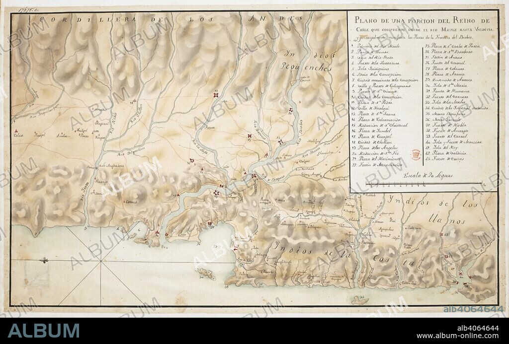
Map of Concepcion and surrounding area, in Chile, orientated with East at the top, with scale, three and a half leagues to an inch, and a key. Plano de una Porcion del Reino de Chile. 18th century. Source: Add. 17675 E. Language: Spanish.

|
Zu einem anderen Lightbox hinzufügen |
|
Zu einem anderen Lightbox hinzufügen |


Haben Sie bereits ein Konto? Anmelden
Sie haben kein Konto? Registrieren
Dieses Bild kaufen.
Nutzung auswählen:

Untertitel:
Siehe automatische Übersetzung
Map of Concepcion and surrounding area, in Chile, orientated with East at the top, with scale, three and a half leagues to an inch, and a key. Plano de una Porcion del Reino de Chile. 18th century. Source: Add. 17675 E. Language: Spanish.
Bildnachweis:
Album / British Library
Freigaben (Releases):
Bildgröße:
8858 x 5538 px | 140.3 MB
Druckgröße:
75.0 x 46.9 cm | 29.5 x 18.5 in (300 dpi)
Schlüsselwörter:


 Pinterest
 Twitter
 Facebook
 Link kopieren
 Email
Email
