alb3840178
Earthquake Zones Map
| Teilen |
|---|
 Pinterest Pinterest |
 Twitter Twitter |
 Facebook Facebook |
 Link kopieren Link kopieren |
 Email Email |
|
Zu einem anderen Lightbox hinzufügen |
|
Zu einem anderen Lightbox hinzufügen |


Haben Sie bereits ein Konto? Anmelden
Sie haben kein Konto? Registrieren
Dieses Bild kaufen

Titel:
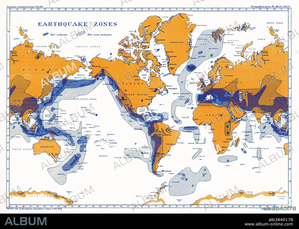
Earthquake Zones Map
Untertitel:
Siehe automatische Übersetzung
A map showing earthquake zones. This world seismicity map clearly shows the correlation of the Pacific Ring of Fire with earthquake epicentres, the Alpine-Himalayan Belt, and the coincidence of major portions of the mid-ocean ridge system with areas of seismicity.
Bildnachweis:
Album / Science Source / National Oceanic and Atmospheric Administration
Freigaben (Releases):
Model: Nein - Eigentum: Nein
Rechtefragen?
Rechtefragen?
Bildgröße:
5140 x 3680 px | 54.1 MB
Druckgröße:
43.5 x 31.2 cm | 17.1 x 12.3 in (300 dpi)
Schlüsselwörter:
ALPIN • ERDBEBEN • FEUER • FEUER, VIER ELEMENTE • GEOLOGIE • GRAFISCH • ILLUSTRATION • ILLUSTRATIONS • MEER • MEERE • OZEAN • SEA • SEESTUECK (GEMAELDE) • VIER ELEMENTE: FEUER • WELT
