alb5481762
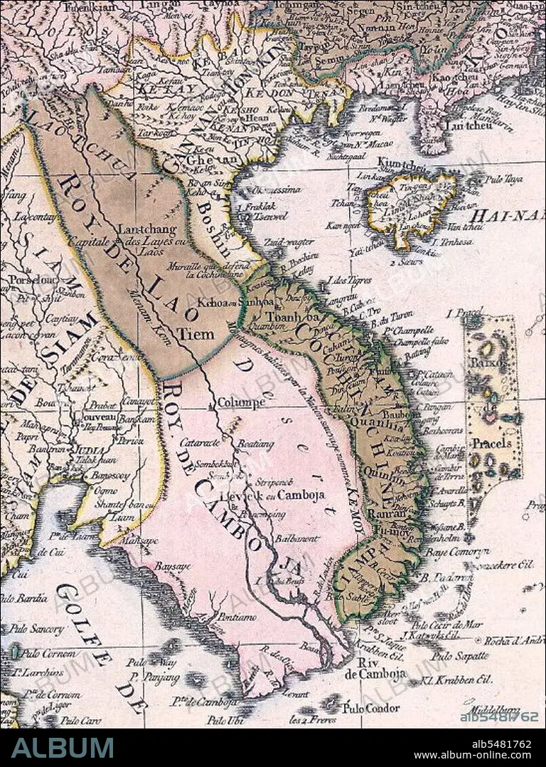
Vietnam: Franco-Dutch map of Indochina, c.1760. The Paracels Islands, disputed between Vietnam and China, are depicted close to the Vietnamese coast
| Teilen |
|---|
 Pinterest Pinterest |
 Twitter Twitter |
 Facebook Facebook |
 Link kopieren Link kopieren |
 Email Email |
|
Zu einem anderen Lightbox hinzufügen |
|
Zu einem anderen Lightbox hinzufügen |


Haben Sie bereits ein Konto? Anmelden
Sie haben kein Konto? Registrieren
Dieses Bild kaufen

Titel:
Vietnam: Franco-Dutch map of Indochina, c.1760. The Paracels Islands, disputed between Vietnam and China, are depicted close to the Vietnamese coast
Untertitel:
Siehe automatische Übersetzung
18th-century map of Vietnam, derives from a map of Southeast Asia and parts of China published in Amsterdam by the firm of Covens and Mortier around 1760. The title of this map is in French, but many of the place names and notes have been translated into Dutch.
Bildnachweis:
Album / Pictures From History/Universal Images Group
Freigaben (Releases):
Model: Nein - Eigentum: Nein
Rechtefragen?
Rechtefragen?
Bildgröße:
3612 x 4816 px | 49.8 MB
Druckgröße:
30.6 x 40.8 cm | 12.0 x 16.1 in (300 dpi)
Schlüsselwörter:
ASIEN • ASIEN, KONTINENT • CHINESIN • CHINESISCH • FEUER, KRIEG • GESCHICHTE • KONTINENT, ASIEN • KRIEG • MILITAER • MILITAR • MILITÄR • MILITÄRISCH • VIETNAM • ZEITGESCHICHTE
