alb9203080
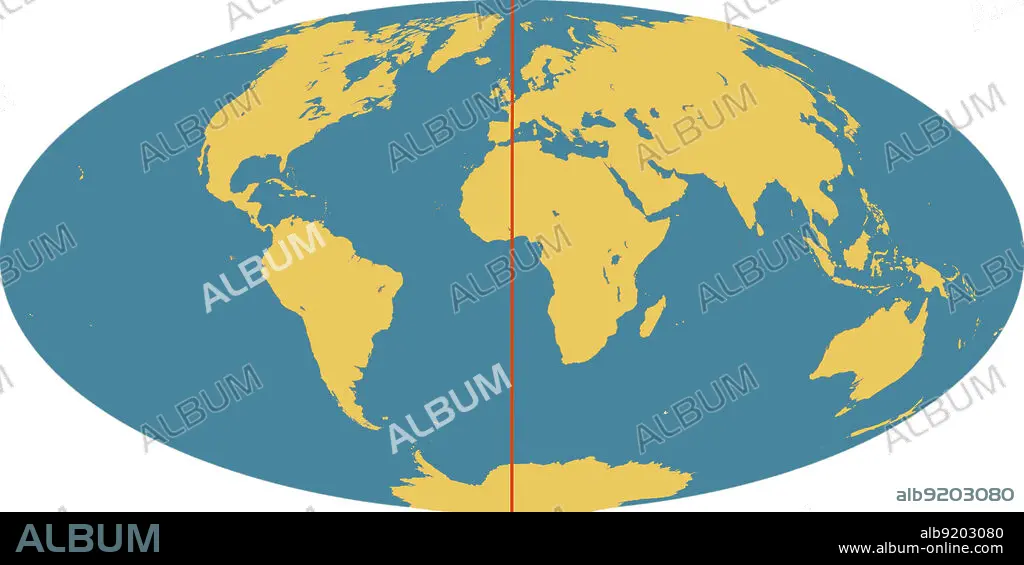
World Map with Prime Meridian
| Teilen |
|---|
 Pinterest Pinterest |
 Twitter Twitter |
 Facebook Facebook |
 Link kopieren Link kopieren |
 Email Email |
|
Zu einem anderen Lightbox hinzufügen |
|
Zu einem anderen Lightbox hinzufügen |


Haben Sie bereits ein Konto? Anmelden
Sie haben kein Konto? Registrieren
Dieses Bild kaufen

Titel:
World Map with Prime Meridian
Untertitel:
Siehe automatische Übersetzung
Outline of world map, showing the continents, oceans and prime meridian (in red). The prime meridian (also known as the Greenwich meridian) exactly marks the position of 0 degrees longitude. It is from this that the longitude of all points on the surface of the Earth are measured. This was agreed by an international convention in 1884. The meridian passes through the original site of the Greenwich observatory.
Bildnachweis:
Album / Science Source / Jessica Wilson/NASA
Freigaben (Releases):
Model: Nein - Eigentum: Nein
Rechtefragen?
Rechtefragen?
Bildgröße:
Nicht verfügbar
Druckgröße:
Nicht verfügbar
