alb4614689
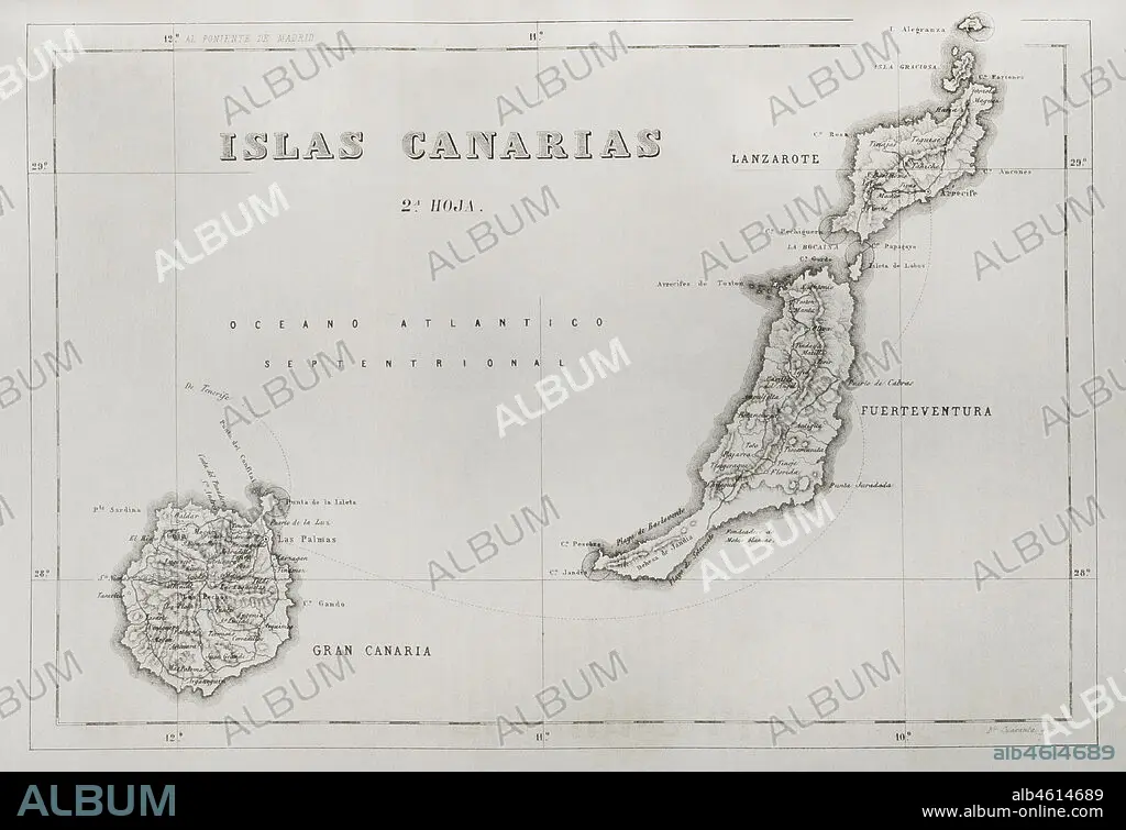
History of Spain. Map of the Canary Islands. Islands of Gran Canaria, Lanzarote and Fuerteventura. Engraving. Crónica General de España, Historia Ilustrada y Descriptiva de sus Provincias (General Chronicle of Spain, Illustrated and Descriptive History of its Provinces), Canaries, 1871.
| Teilen |
|---|
 Pinterest Pinterest |
 Twitter Twitter |
 Facebook Facebook |
 Link kopieren Link kopieren |
 Email Email |
|
Zu einem anderen Lightbox hinzufügen |
|
Zu einem anderen Lightbox hinzufügen |


Haben Sie bereits ein Konto? Anmelden
Sie haben kein Konto? Registrieren
Dieses Bild kaufen

Untertitel:
Siehe automatische Übersetzung
History of Spain. Map of the Canary Islands. Islands of Gran Canaria, Lanzarote and Fuerteventura. Engraving. Crónica General de España, Historia Ilustrada y Descriptiva de sus Provincias (General Chronicle of Spain, Illustrated and Descriptive History of its Provinces), Canaries, 1871.
Standort:
Privatsammlung
Bildnachweis:
Album / Prisma
Freigaben (Releases):
Model: Nein - Eigentum: Nein
Rechtefragen?
Rechtefragen?
Bildgröße:
4613 x 3164 px | 41.8 MB
Druckgröße:
39.1 x 26.8 cm | 15.4 x 10.5 in (300 dpi)
Schlüsselwörter:
ATLANTIK • ATLANTISCHER OZEAN • CANARY ISLANDS • GEOGRAFIE • GEOGRAPHIE • GESCHICHTE • GRAVUR • INSEL • KARTE (KARTHOGRAFIE) • KARTEN • KARTHOGRAFIE • KARTHOGRAPHIE • KARTOGRAFIE (KARTE) • KARTOGRAPHIE • LANDKARTE • PLAN (KARTOGRAPHIE) • PRIVATSAMMLUNG • PROVINZ • SPANIEN • STICH (KUNST) • WISSENSCH.: KARTOGRAPHIE • ZEITGESCHICHTE
