alb9412721
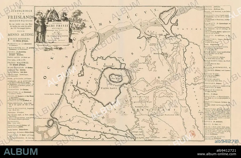
Historical map of the Netherlands with the territories of the Batavians and Frisians, Descriptio agri Frisii Antiqui (...) / Afbeeldinge van Frieslands boodem bij ouds (...) (title on object), Map of the Frisian territories in Roman times. Top left cartouche with title, surrounded by arms and Frisian chieftains Verritus and Malorix, in the background warriors. Scale bar below cartouche: Semis gradus. Left and right of print strips of letterpress text with Dutch translation of title (upper left) and terms used on map., print maker: Jan Luyken, Menso Alting, (mentioned on object), Netherlands, 1697 - 1700 and/or 1718 and/or 1725, paper, engraving, etching, letterpress printing, height 335 mm × width 426 mm, height 336 mm × width 556 mm.
| Teilen |
|---|
 Pinterest Pinterest |
 Twitter Twitter |
 Facebook Facebook |
 Link kopieren Link kopieren |
 Email Email |
|
Zu einem anderen Lightbox hinzufügen |
|
Zu einem anderen Lightbox hinzufügen |


Haben Sie bereits ein Konto? Anmelden
Sie haben kein Konto? Registrieren
Dieses Bild kaufen

Untertitel:
Siehe automatische Übersetzung
Historical map of the Netherlands with the territories of the Batavians and Frisians, Descriptio agri Frisii Antiqui (...) / Afbeeldinge van Frieslands boodem bij ouds (...) (title on object), Map of the Frisian territories in Roman times. Top left cartouche with title, surrounded by arms and Frisian chieftains Verritus and Malorix, in the background warriors. Scale bar below cartouche: Semis gradus. Left and right of print strips of letterpress text with Dutch translation of title (upper left) and terms used on map., print maker: Jan Luyken, Menso Alting, (mentioned on object), Netherlands, 1697 - 1700 and/or 1718 and/or 1725, paper, engraving, etching, letterpress printing, height 335 mm × width 426 mm, height 336 mm × width 556 mm
Bildnachweis:
Album / quintlox
Freigaben (Releases):
Model: Nein - Eigentum: Nein
Rechtefragen?
Rechtefragen?
Bildgröße:
5025 x 3021 px | 43.4 MB
Druckgröße:
42.5 x 25.6 cm | 16.8 x 10.1 in (300 dpi)
Schlüsselwörter:
