alb4093315
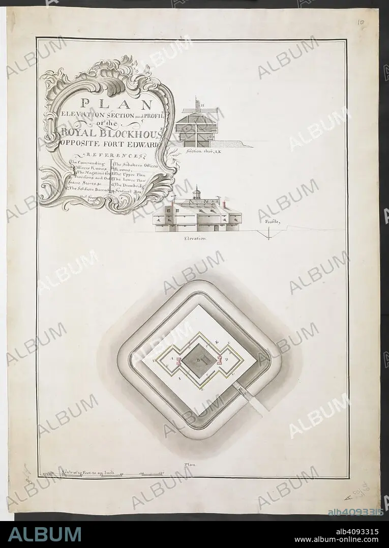
Plan elevation section and profile of the Royal Blockhouse opposite Fort Edward' by Thomas Sowers; 1759. . R.U.S.I. MAPS. Vol. LXXVI (1-13). 57711 (1-4). Places in states North-East of New York. 18th century. 1759. 1:240. 'Scale of 20 feet to an inch'. Scale bar of 120 feet (= 6 inches). 555 x 395mm. Source: Add. 57711. Amherst no. A 78. R.U.S.I. no. A 28.64.
| Teilen |
|---|
 Pinterest Pinterest |
 Twitter Twitter |
 Facebook Facebook |
 Link kopieren Link kopieren |
 Email Email |
|
Zu einem anderen Lightbox hinzufügen |
|
Zu einem anderen Lightbox hinzufügen |


Haben Sie bereits ein Konto? Anmelden
Sie haben kein Konto? Registrieren
Dieses Bild kaufen

Untertitel:
Siehe automatische Übersetzung
Plan elevation section and profile of the Royal Blockhouse opposite Fort Edward' by Thomas Sowers; 1759. . R.U.S.I. MAPS. Vol. LXXVI (1-13). 57711 (1-4). Places in states North-East of New York. 18th century. 1759. 1:240. 'Scale of 20 feet to an inch'. Scale bar of 120 feet (= 6 inches). 555 x 395mm. Source: Add. 57711. Amherst no. A 78. R.U.S.I. no. A 28.64.
Persönlichkeiten:
Bildnachweis:
Album / British Library
Freigaben (Releases):
Model: Nein - Eigentum: Nein
Rechtefragen?
Rechtefragen?
Bildgröße:
6312 x 8448 px | 152.6 MB
Druckgröße:
53.4 x 71.5 cm | 21.0 x 28.2 in (300 dpi)
Schlüsselwörter:
18. JAHRHUNDERT • 18. JH. • DOKUMENT • EREIGNIS • FEUER, KRIEG • KRIEG • MILITAER • MILITAERBAUTEN • MILITAR • MILITÄR • MILITÄRISCH • PLAN
