alb1963307
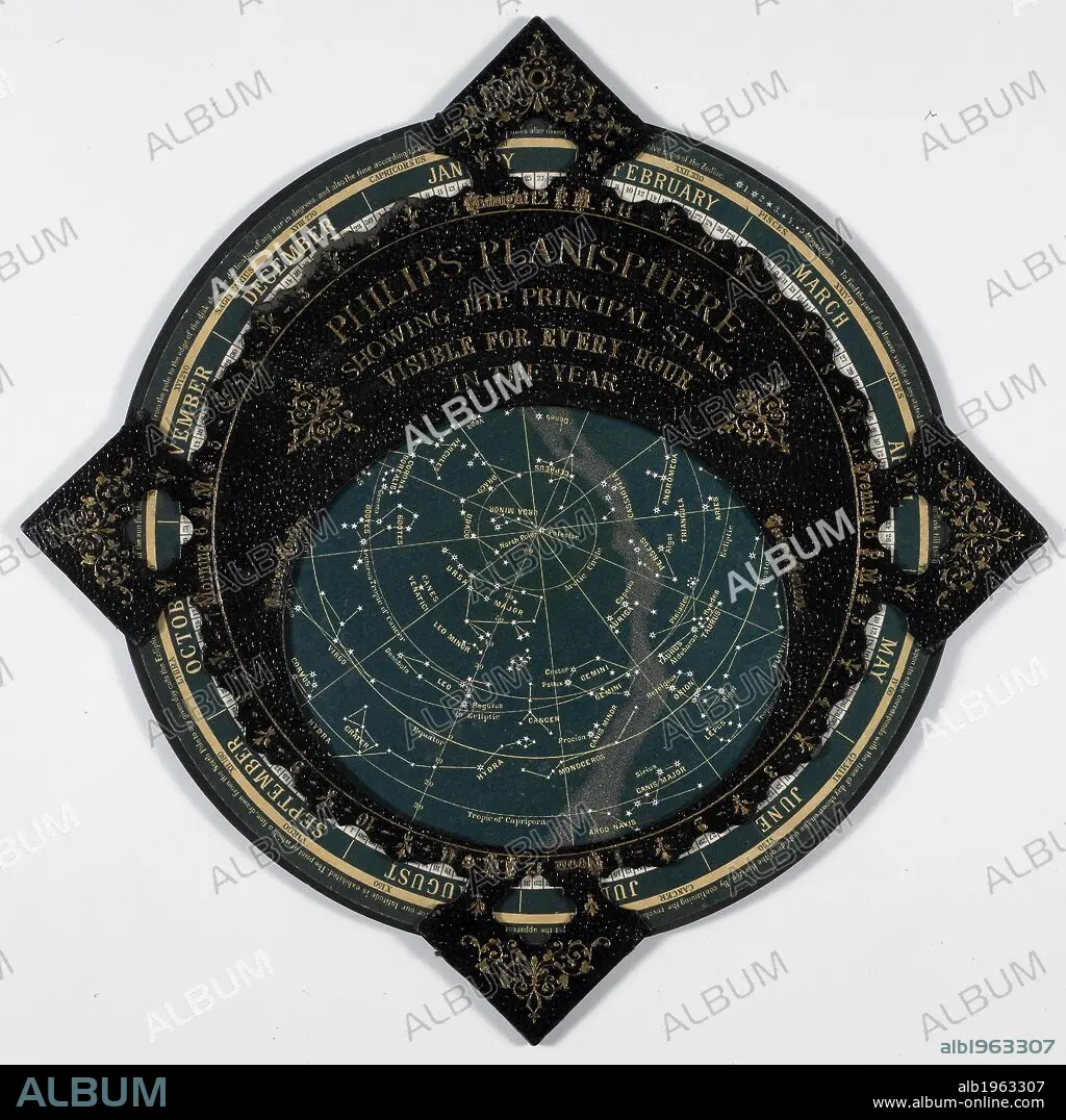
Philips Planisphere 1887. A map of the stars. . Philips’ Planisphere, showing the principal Stars visible for every hour in the year. London and Liverpool, England. Source: Maps 9.c.36. Language: English.
| Teilen |
|---|
 Pinterest Pinterest |
 Twitter Twitter |
 Facebook Facebook |
 Link kopieren Link kopieren |
 Email Email |
|
Zu einem anderen Lightbox hinzufügen |
|
Zu einem anderen Lightbox hinzufügen |


Haben Sie bereits ein Konto? Anmelden
Sie haben kein Konto? Registrieren
Dieses Bild kaufen

Untertitel:
Siehe automatische Übersetzung
Philips Planisphere 1887. A map of the stars. . Philips’ Planisphere, showing the principal Stars visible for every hour in the year. London and Liverpool, England. Source: Maps 9.c.36. Language: English.
Bildnachweis:
Album / British Library
Freigaben (Releases):
Model: Nein - Eigentum: Nein
Rechtefragen?
Rechtefragen?
Bildgröße:
4018 x 4016 px | 46.2 MB
Druckgröße:
34.0 x 34.0 cm | 13.4 x 13.4 in (300 dpi)
Schlüsselwörter:
ASTRONOMIE • DOKUMENT • GESTIRN • ILLUSTRATION • ILLUSTRATIONS • KARTE (KARTHOGRAFIE) • KARTE • KARTEN • KARTHOGRAFIE • KARTHOGRAPHIE • KARTOGRAFIE (KARTE) • KARTOGRAPHIE • LANDKARTE • NATURKUNDE • NATURWISSENSCHAFT • PLAN (KARTOGRAPHIE) • SONNENSYSTEM • STERN • WISSENSCH.: ASTRONOMIE • WISSENSCH.: KARTOGRAPHIE • WISSENSCHAFT • WISSENSCHAFTEN
