alb3794024
Topographical Map of Coordinates 45 S, 0 E
| Share |
|---|
 Pinterest Pinterest |
 Twitter Twitter |
 Facebook Facebook |
 Copy link Copy link |
 Email Email |
|
Add to another lightbox |
|
Add to another lightbox |


Title:
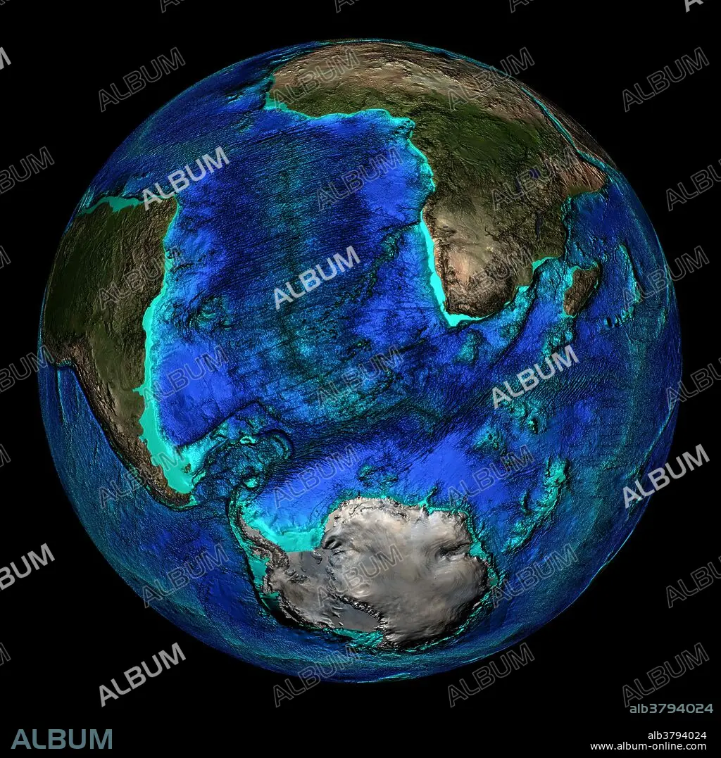
Topographical Map of Coordinates 45 S, 0 E
Caption:
Topographical map of the Earth, centered on 45 degrees South, 0 degrees East. Visible is the mid-Atlantic Ridge which runs along the entire length of the Atlantic Ocean. The seas and oceans are color-coded by depth and land colors are based on MODIS true-color data from the Terra satellite in 2004 where darker regions represent highlands. Turquoise regions represent the continental shelf and descend to around 150 meters before dropping off abruptly at the shelf break. The descent of the continental slope to the ocean floor is shown as increasingly dark shades of blue.
Credit:
Album / NOAA/Science Source
Releases:
Model: No - Property: No
Rights questions?
Rights questions?
Image size:
2400 x 2400 px | 16.5 MB
Print size:
20.3 x 20.3 cm | 8.0 x 8.0 in (300 dpi)
Keywords:
0 DEGREES EAST • 0 E • 45 DEGREES SOUTH • 45 S • AFRICA • AFRICAN CONTINENT • AFRICAN • ANTARCTICA • ATLANTIC OCEAN • ATLANTIC • AUSTRALIAN • BATHYMETRY • BRITISH • CIRCLE • CIRCULAR • CONTINENT • CONTINENTAL PLATE • DEPTH • EARTH SCIENCE • EARTH • FLEET • FROM SPACE • GEOGRAPHICAL • GEOGRAPHY • GLOBAL • GLOBE • MADAGASCAR • MARINE • MID-ATLANTIC RIDGE • MODIS • NAVY • NORTH AMERICA • OCEAN • OCEAN, ATLANTIC • OCEANOGRAPHY • PLANET • ROUND • SATELLITE IMAGE • SCIENCES • SEA BED • SEA FLOOR • SEA • SEABED • SOUTH AMERICA • SOUTH AMERICAN • SOUTH POLE • TECTONIC • TERRA • TOPOGRAPHICAL • TOPOGRAPHY • WHOLE EARTH
