alb3842854
Geology of Hawaiian Islands
| Share |
|---|
 Pinterest Pinterest |
 Twitter Twitter |
 Facebook Facebook |
 Copy link Copy link |
 Email Email |
|
Add to another lightbox |
|
Add to another lightbox |


Title:
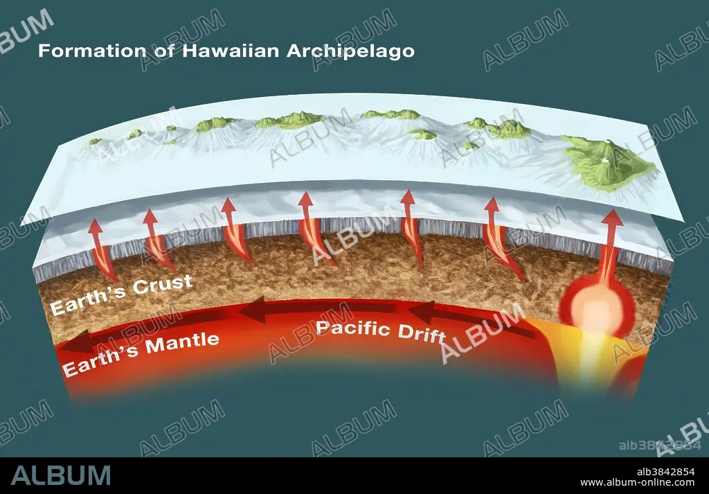
Geology of Hawaiian Islands
Caption:
The geology of the Hawaiian Islands. This illustration shows the archipelago and underwater topography of the Hawaiian Islands. These volcanic islands, located in the northern Pacific Ocean, have formed as volcanoes rising from a mantle hot spot under the sea floor some 5500 meters below sea level. There are eight main islands (as pictured here): Big Island (Hawaii Island), Maui, O'ahu, Kaua'i, Moloka'i, Lana'i, Ni'ihau, and Kaho'olawe. The highest point is the peak of the Mauna Kea volcano (on Big Island), at 4205 meters elevation.
Credit:
Album / Science Source / Spencer Sutton
Releases:
Model: No - Property: No
Rights questions?
Rights questions?
Image size:
3903 x 2514 px | 28.1 MB
Print size:
33.0 x 21.3 cm | 13.0 x 8.4 in (300 dpi)
Keywords:
ANNOTATED • ARCHIPELAGO • ART • ARTWORK • BIG ISLAND • DIAGRAM • EARTH SCIENCE • EARTH'S CRUST • EARTH'S MANTLE • GEOGRAPHICAL • GEOGRAPHY • GEOLOGICAL • GEOLOGY • HAWAI'I • HAWAII ISLAND • HAWAII • HAWAIIAN ISLANDS • ILLUSTRATION • INFO-GRAPHIC • INFO-GRAPHICS • INFOGRAPHIC • INFOGRAPHICS • INFORMATION GRAPHICS • ISLAND • KAHOOLAWE • KAUAI • LANAI • MANTLE HOT SPOT • MAUI • MAUNA KEA • MOLOKAI • OAHU • OCEAN, PACIFIC • PACIFIC DRIFT • PACIFIC OCEAN • SEA • TOPOGRAPHIC • TOPOGRAPHY • UNDERWATER • VOLCANIC • VOLCANIC_ERUPTION • VOLCANO • VOLCANOES • VOLCANOLOGY • VOLCANOS • VULCAN • VULCANO
