alb11546271
GIDEON HAWLEY. Plan of Mashpee
| Share |
|---|
 Pinterest Pinterest |
 Twitter Twitter |
 Facebook Facebook |
 Copy link Copy link |
 Email Email |
|
Add to another lightbox |
|
Add to another lightbox |


Author:
Title:
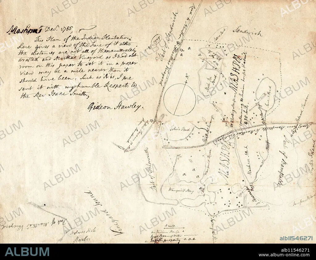
Plan of Mashpee
Caption:
Plan of Mashpee / Plan of the indian plantations. map of the Mashpee Indian lands on Cape Cod. Shows Indian houses, streams, and English property. "Dec. 1785, This plan of the Indian Plantations here gives a view of the face of it altho the distances are not all of them accurately drafted and Martha's Vineyard as I had not enough room on this paper to set it in a proper view may be a mile nearer than it should have been. Such as it is, I sent it with my humble respects to the Rev. Isaac Smith. Gideon Hawley." Such is a survey sketch that provides an early example of the treaties between American leaders and native peoples that designated land for their use. Gideon Hawley, a Christian missionary to the Mashpee Indians, drew this reservation map for Reverend Isaac Smith in 1785. Like most Native American tribes in Massachusetts, the Mashpee lived on Cape Cod. The Mashpee fought with the Americans during the Revolutionary War and suffered heavy losses. In 1783, Hawley noted that there were at least 70 widows on the Mashpee reservation, most of whom had lost their husbands during the war. Gideon Hawley (1727-1807).
Credit:
Album / The Pierce Archive
Releases:
Model: No - Property: No
Rights questions?
Rights questions?
Image size:
3909 x 3011 px | 33.7 MB
Print size:
33.1 x 25.5 cm | 13.0 x 10.0 in (300 dpi)
Keywords:
AMERICAN REVOLUTION • CAPE COD • GIDEON HAWLEY • INDIAN • MAP • MASHPEE • MASSACHUSETTS • NATIVE AMERICAN • PLANTATION • SETTLEMENT • US
