alb3801529
Carolingian Empire, 9th Century
| Share |
|---|
 Pinterest Pinterest |
 Twitter Twitter |
 Facebook Facebook |
 Copy link Copy link |
 Email Email |
|
Add to another lightbox |
|
Add to another lightbox |


Title:
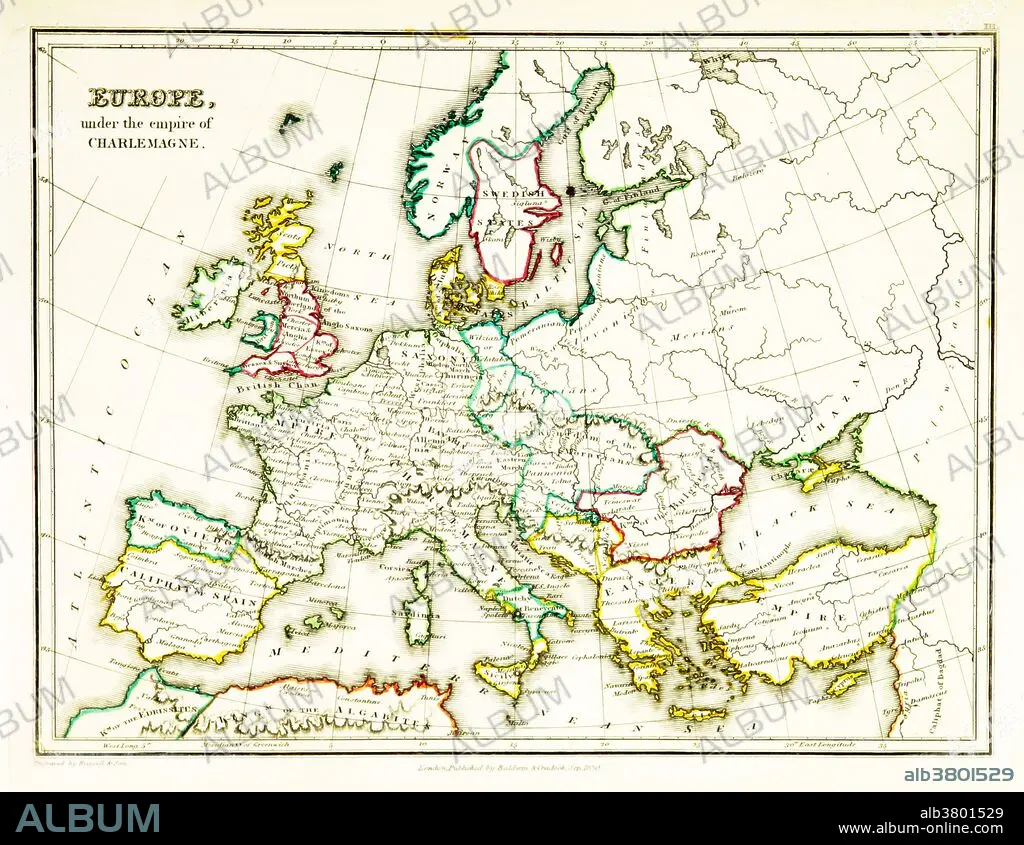
Carolingian Empire, 9th Century
Caption:
A map of Europe, showing territorial borders existing in the 9th century, under the reign of Charlemagne. Charlemagne (748-814) was the King of the Franks from 768, the King of Italy from 774, and from 800 the first emperor in western Europe since the collapse of the Western Roman Empire three centuries earlier. The expanded Frankish state he founded is called the Carolingian Empire. Map published in 1831.
Credit:
Album / Science Source / British Library
Releases:
Model: No - Property: No
Rights questions?
Rights questions?
Image size:
3543 x 2742 px | 27.8 MB
Print size:
30.0 x 23.2 cm | 11.8 x 9.1 in (300 dpi)
Keywords:
800S • 9TH CENTURY • ART • ARTWORK • BORDERS • CAROLINGIAN • CARTOGRAPHY • CHANGING • CHARLEMAGNE • CHARLES I • CHARLES THE GREAT • COUNTRIES • DRAWING • EMPEROR CHARLEMAGNE • EMPIRE • EUROPE • EUROPEA • EUROPEAN • FRANCE • FRANCONIAN • FRANKISH • HISTORIC • HISTORICAL • HISTORY • ILLUSTRATION • MAP MAKING • MAP • SEQUENCE • TERRITORY
