alb1653548
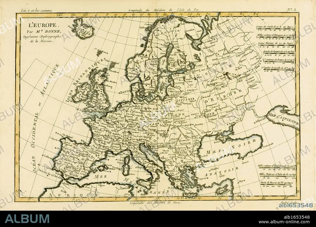
Map of Europe, circa 1760. From 'Atlas de Toutes Les Parties Connues du Globe Terrestre ' by Cartographer Rigobert Bonne. Published Geneva circa. 1760.
| Share |
|---|
 Pinterest Pinterest |
 Twitter Twitter |
 Facebook Facebook |
 Copy link Copy link |
 Email Email |
|
Add to another lightbox |
|
Add to another lightbox |


Caption:
Map of Europe, circa 1760. From 'Atlas de Toutes Les Parties Connues du Globe Terrestre ' by Cartographer Rigobert Bonne. Published Geneva circa. 1760.
Credit:
Album / Universal History Archive/Universal Images Group
Releases:
Model: No - Property: No
Rights questions?
Rights questions?
Image size:
5670 x 3780 px | 61.3 MB
Print size:
48.0 x 32.0 cm | 18.9 x 12.6 in (300 dpi)
Keywords:
CARTOGRAPHY • COLOR • COLOUR • ENGRAVED • ENGRAVING (ARTWORK) • ENGRAVING • ENGRAVING. • ENGRAVINGS • ETCHING • EUROPE • GEOGRAPHY • HORIZONTAL • ILLUSTRATION • KEN • MAP MAKING • MAP • MAPMAKING • PLAN (CARTOGRAPHY) • PLATE • PRINT • WELSH
