alb3808235
Map of Livingstone's Route Across Africa, 1857
| Share |
|---|
 Pinterest Pinterest |
 Twitter Twitter |
 Facebook Facebook |
 Copy link Copy link |
 Email Email |
|
Add to another lightbox |
|
Add to another lightbox |


Title:
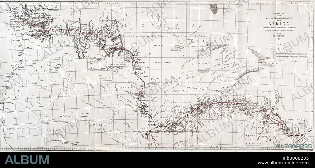
Map of Livingstone's Route Across Africa, 1857
Caption:
Map showing the route of David Livingstone across central Africa via the Zambesi River to the east coast, 1857. David Livingstone (1813-1873) was a Scottish explorer and medical missionary in Africa. He organized expeditions into the interior of Africa from Botswana, discovered and named Victoria Falls, and located the mouth of the Zambesi River. He mapped much of interior Africa, wrote accounts of the inhabitants, and campaigned against slavery. Along with Henry Morton Stanley, he became a celebrity in the eyes of a Victorian public captivated by their explorations.
Credit:
Album / Science Source / Wellcome Images
Releases:
Model: No - Property: No
Rights questions?
Rights questions?
Image size:
5603 x 2700 px | 43.3 MB
Print size:
47.4 x 22.9 cm | 18.7 x 9.0 in (300 dpi)
Keywords:
1800S • 1850S • 1857 • 19TH CENTURY • AFRICA • AFRICAN CONTINENT • AFRICAN • ART • ARTWORK • BOTSWANA • BW • CENTRAL AFRICA • COLONIAL • COLONIALISM • DAVID LIVINGSTONE • DRAWING • ENGLISH • EXPEDITION • EXPLORATION • EXPLORING • HISTORIC • HISTORICAL • HISTORY • ILLUSTRATION • INTERIOR • JOURNEY • LIVINGSTONE • MAP • MAPPING • PATH • ROUTE • SCOTTISH • VICTORIA FALLS • ZAMBESI RIVER • ZAMBESI • ZAMBEZI
