alb3453969
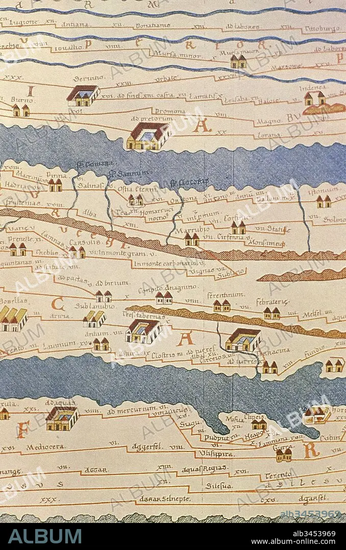
Tabula Peutingeriana or Peutinger Table. An illustrated itinerarium (ancient Roman road map) showing the layout of the road network of the Roman Empire. Painted on parchment, it is a medieval copy (13th century) of an original map of the 4th century. Detail of Italy. National Library of Vienna. Austria.
| Share |
|---|
 Pinterest Pinterest |
 Twitter Twitter |
 Facebook Facebook |
 Copy link Copy link |
 Email Email |
|
Add to another lightbox |
|
Add to another lightbox |


Caption:
Tabula Peutingeriana or Peutinger Table. An illustrated itinerarium (ancient Roman road map) showing the layout of the road network of the Roman Empire. Painted on parchment, it is a medieval copy (13th century) of an original map of the 4th century. Detail of Italy. National Library of Vienna. Austria.
Credit:
Album / Prisma
Releases:
Model: No - Property: No
Rights questions?
Rights questions?
Image size:
3712 x 5610 px | 59.6 MB
Print size:
31.4 x 47.5 cm | 12.4 x 18.7 in (300 dpi)
Keywords:
13TH CENTURY • 4TH CENTURY A. C. • 4TH CENTURY A. D • 4TH CENTURY A. D. • 4TH CENTURY AC • 4TH CENTURY AD • 4TH CENTURY • ANCIENT AGE • ANCIENT CARTOGRAPHY • ANCIENT HISTORY • CARTOGRAPHY • CARTOUCHE • CHART • CHIMNEY • COPY • CURSUS PUBLICUS • EARLY MIDDLE AGES • EPOCA • EPOCH • ERA • FOURTH CENTURY A. D. • FOURTH CENTURY • HIGHWAY • HISTORIA UNIVERSAL • HISTORY • ILLUSTRATED • ITALIA • ITALY • ITINERARIES • ITINERARIUM • ITINERARY • MAP MAKING • MAP • MEDIAEVAL • MEDIEVAL • MEDIOEVO • MIDDLE AGE • MIDDLE AGES • MOYEN AGE • NET • NETWORK • OLD MAP • PARCHMENT • PATHWAY • PEUTINGER MAP • PEUTINGER TABLE • PEUTINGER'S TABULA • PLAN (CARTOGRAPHY) • PULLEY • RED • ROAD • ROADS • ROLL • ROMAN EMPIRE • ROMAN ERA • ROMAN PERIOD • ROMAN • ROMANO • ROME • RUA • SCROLL • STREET • TABULA PEUTINGERIANA • TRAIL • VIA • WAY
