alb4076471
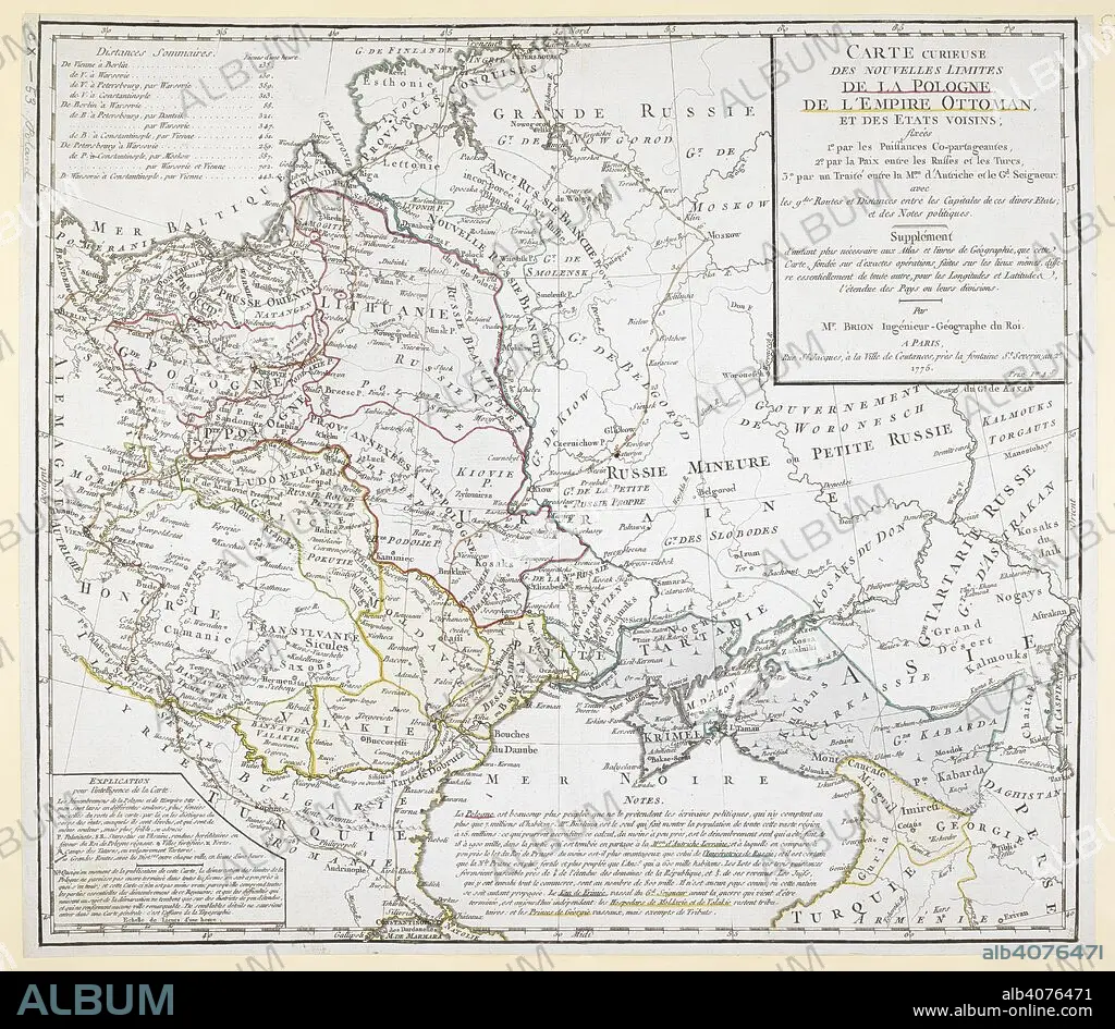
An 18th century map covering Russia; Ukraine; Poland (after the first partition); Lithuania; Tartary; Transylvania; Turkey; Hungary and surrounding territories. . Carte curieuse des nouvelles limites de la Pologne, de l'Empire Ottoman, et des EÌtats voisins, par M. Brion. 1775. Source: Maps.K.Top.110.53. Language: French.
| Share |
|---|
 Pinterest Pinterest |
 Twitter Twitter |
 Facebook Facebook |
 Copy link Copy link |
 Email Email |
|
Add to another lightbox |
|
Add to another lightbox |


Caption:
An 18th century map covering Russia; Ukraine; Poland (after the first partition); Lithuania; Tartary; Transylvania; Turkey; Hungary and surrounding territories. . Carte curieuse des nouvelles limites de la Pologne, de l'Empire Ottoman, et des EÌtats voisins, par M. Brion. 1775. Source: Maps.K.Top.110.53. Language: French.
Credit:
Album / British Library
Releases:
Model: No - Property: No
Rights questions?
Rights questions?
Image size:
5901 x 5138 px | 86.7 MB
Print size:
50.0 x 43.5 cm | 19.7 x 17.1 in (300 dpi)
Keywords:
18TH CENTURY • 18TH CENTURY, THE • 20 XX TWENTIETH CENTURY • 20TH CENTURY • CARTE • CARTOGRAPHIC • CARTOGRAPHY • CENTRAL EUROPE • COLOR • COLORS • COLOUR • COLOURS • EASTERN EUROPE • EUROPE • HUNGARIAN • HUNGARY • LITHUANIA • MAP MAKING • MAP • NORTHERN EUROPE • PLAN (CARTOGRAPHY) • POLAND • ROMANIA • RUMANIA • RUSIA • RUSSIA • TRANSYLVANIA • TURKEY • TWENTIETH CENTURY • UCRANIA • UKRAINE
