alb2595348
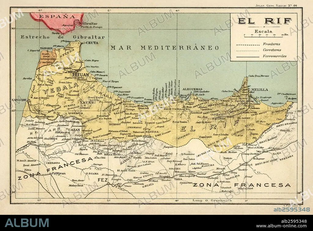
España. Mapa de El Rif, con los límites de las colonias españolas en el norte de África en los años 1920.
| Share |
|---|
 Pinterest Pinterest |
 Twitter Twitter |
 Facebook Facebook |
 Copy link Copy link |
 Email Email |
|
Add to another lightbox |
|
Add to another lightbox |


Caption:
Automatic translation: Spain. Map of El Rif, with the limits of the Spanish colonies in North Africa in the 1920s
España. Mapa de El Rif, con los límites de las colonias españolas en el norte de África en los años 1920
Credit:
Album / Documenta
Releases:
Model: No - Property: No
Rights questions?
Rights questions?
Image size:
5546 x 3811 px | 60.5 MB
Print size:
47.0 x 32.3 cm | 18.5 x 12.7 in (300 dpi)
Keywords:
20TH CENTURY • AFRICA • AFRICAN • CEUTA • GEOGRAPHY • HISTORIA UNIVERSAL • HISTORY • MAP • MELILLA • PLAN (CARTOGRAPHY) • RIF • SPAIN
