alb5405841
Medieval World, T-O Map
| Share |
|---|
 Pinterest Pinterest |
 Twitter Twitter |
 Facebook Facebook |
 Copy link Copy link |
 Email Email |
|
Add to another lightbox |
|
Add to another lightbox |


Title:
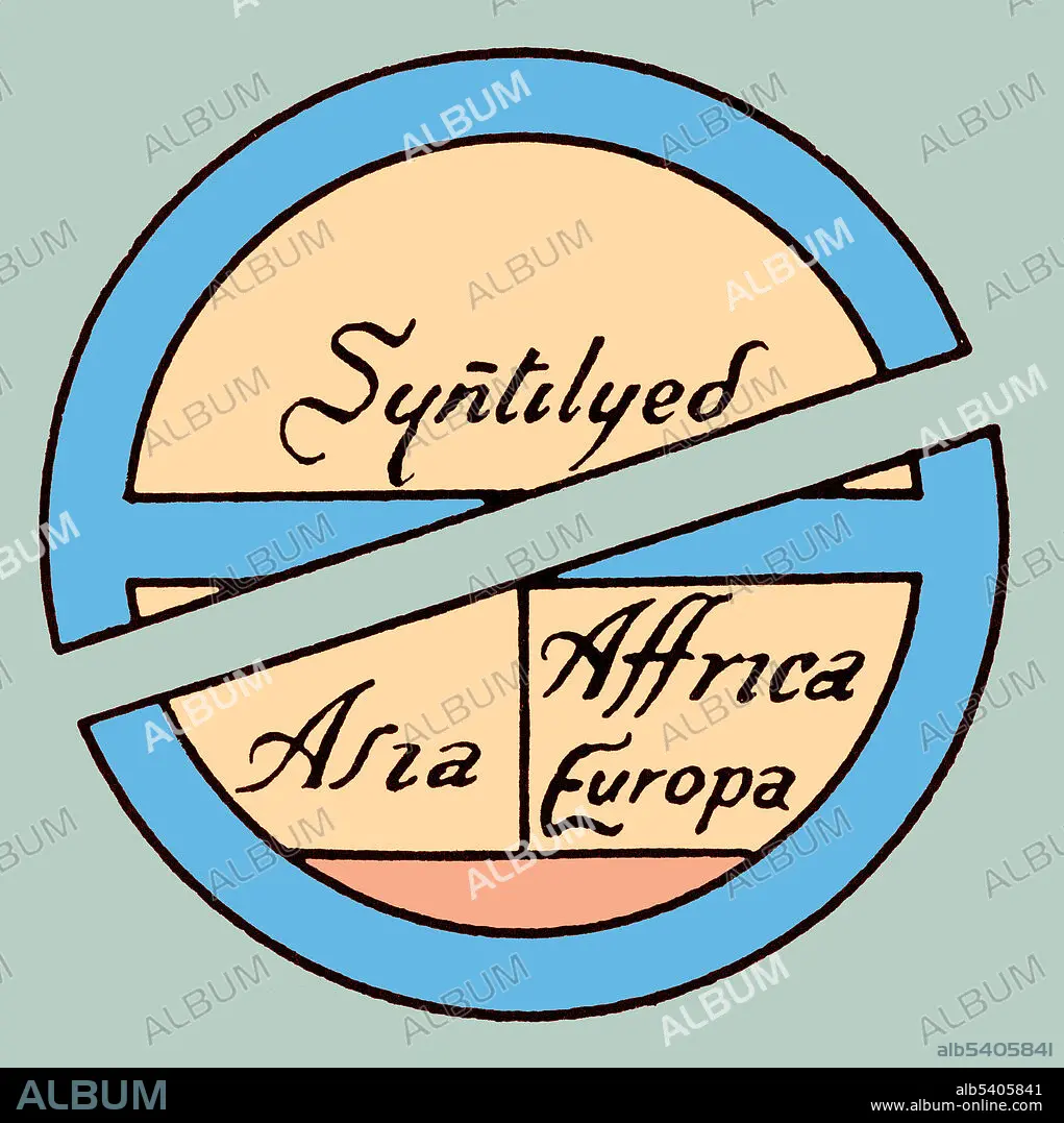
Medieval World, T-O Map
Caption:
Diagrammatic T-O map. The world portrayed as a circle divided by a T shape into three continents, Asia, Europe, and Africa. At the base of the circle is Gades. A T and O map or O-T or T-O map (orbis terrarum, orb or circle of the lands; with the letter T inside an O), is a type of medieval world map, sometimes also called a Beatine map or a Beatus map because one of the earliest known representations of this sort is attributed to Beatus of Liébana, an 8th century Spanish monk. The T is the Mediterranean, the Nile, and the Don (formerly called the Tanais) dividing the three continents, Asia, Europe and Africa, and the O is the encircling ocean.
Credit:
Album / Science Source
Releases:
Model: No - Property: No
Rights questions?
Rights questions?
Image size:
3750 x 3762 px | 40.4 MB
Print size:
31.8 x 31.9 cm | 12.5 x 12.5 in (300 dpi)
Keywords:
BEATUS MAP • CARTOGRAPHY • CELEBRITY • COLORIZED • ECUMENE • ENHANCED • FAMOUS • GEOGRAPHY • HISTORY • ILLUSTRATION • MAP MAKING • MAP OF THE WORLD • MAP • MAPMAKING • MEDIEVAL • ORBIS TERRARUM • T AND O MAP • WORLD MAP
