alb3969841
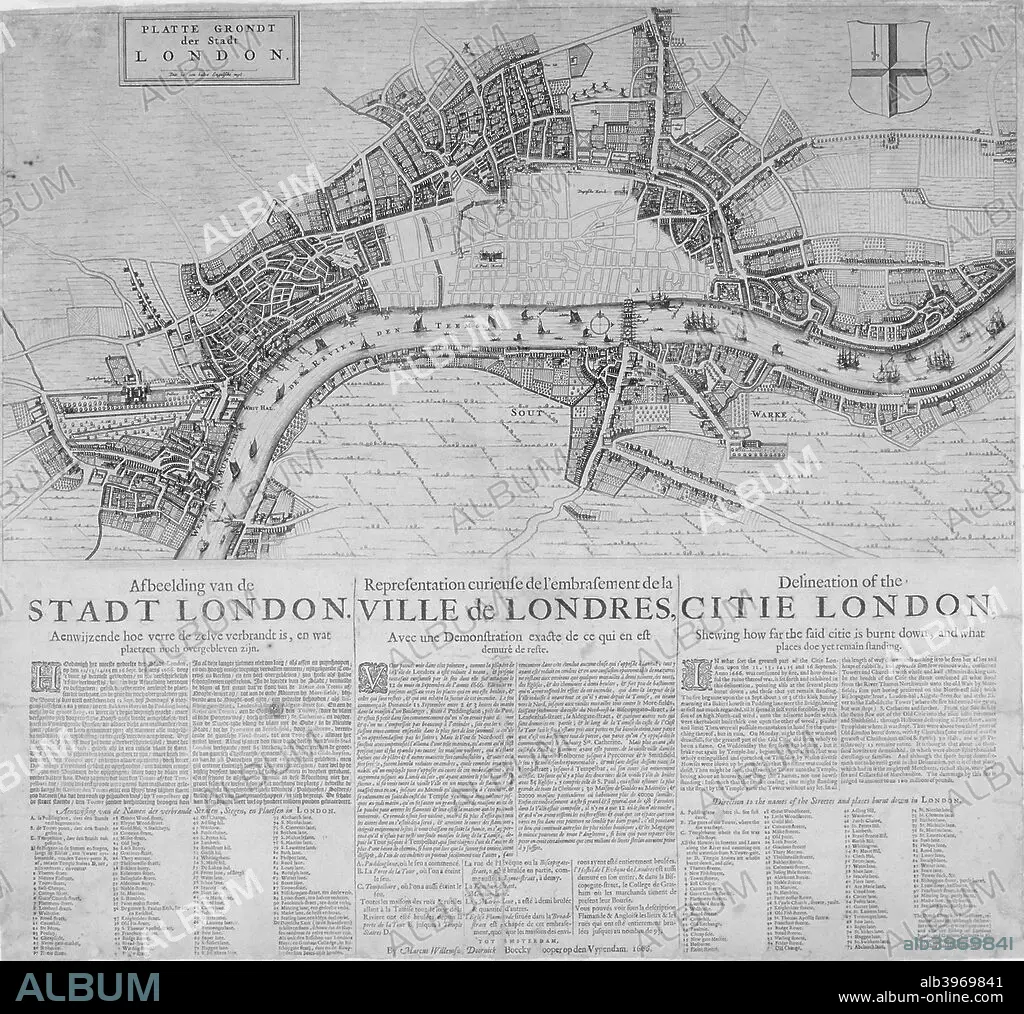
Map of London showing the destruction caused by the Great Fire, 1666. Artist: Anon
| Share |
|---|
 Pinterest Pinterest |
 Twitter Twitter |
 Facebook Facebook |
 Copy link Copy link |
 Email Email |
|
Add to another lightbox |
|
Add to another lightbox |


Title:
Map of London showing the destruction caused by the Great Fire, 1666. Artist: Anon
Caption:
Map of London showing the destruction caused by the Great Fire, 1666. With a description in Dutch, French and English below.
Credit:
Album / The London Archives (City of London)/Heritage Images
Releases:
Model: No - Property: No
Rights questions?
Rights questions?
Image size:
2588 x 2428 px | 18.0 MB
Print size:
21.9 x 20.6 cm | 8.6 x 8.1 in (300 dpi)
Keywords:
17TH CENTURY • ANON • ANONYMOUS • BLACK & WHITE • BLACK AND WHITE • BRITAIN • BRITISH • CARTOGRAPHY • CATASTROPHE • CENTURY • CONCEPT • COUNTRY • DESTRUCTION • DEVASTATION • DISASTER • DUTCH • ENGLAND • ENGLISH • ENGRAVING • EVENT • GEOGRAPHICAL FEATURE • GEOGRAPHY • GREAT FIRE OF LONDON 1666 • GUILDHALL LIBRARY & ART GALLERY • HOLLAND • LOCATION • LONDON • MAP MAKING • MAP • MAP-MAKING • MARCUS WILLEMSZ DOORNICK; DOORNICK • MARCUS WILLEMSZ • MONOCHROMATIC • MONOCHROME • RIVER THAMES • RIVER • SEVENTEENTH CENTURY • THAMES
