alb9609453
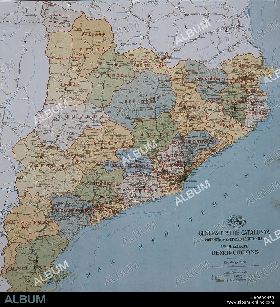
Mapa. 1er projecte demarcacions. Ponencia de la divisio territorial. Generalitat de Catalunya.
| Share |
|---|
 Pinterest Pinterest |
 Twitter Twitter |
 Facebook Facebook |
 Copy link Copy link |
 Email Email |
|
Add to another lightbox |
|
Add to another lightbox |


Caption:
See automatic translation
Mapa. 1er projecte demarcacions. Ponencia de la divisio territorial. Generalitat de Catalunya.
Credit:
Album / Ramon Manent
Releases:
Model: No - Property: No
Rights questions?
Rights questions?
Image size:
2876 x 3000 px | 24.7 MB
Print size:
24.4 x 25.4 cm | 9.6 x 10.0 in (300 dpi)
Keywords:
