alb9619001
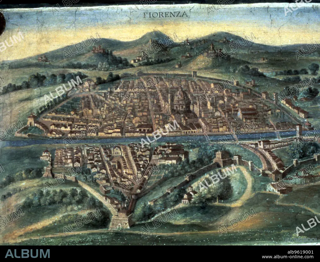
Map of Florence, 15th century. Artist: Unknown
| Share |
|---|
 Pinterest Pinterest |
 Twitter Twitter |
 Facebook Facebook |
 Copy link Copy link |
 Email Email |
|
Add to another lightbox |
|
Add to another lightbox |


Title:
Map of Florence, 15th century. Artist: Unknown
Caption:
Map of Florence, 15th century. View of the city showing the River Arno and Brunelleschi's Duomo. From the Gallery of Maps, Vatican Museum, Vatican City, Italy.
Credit:
Album / Ann Ronan Picture Library/Heritage-Images
Releases:
Model: No - Property: No
Rights questions?
Rights questions?
Image size:
4769 x 3660 px | 49.9 MB
Print size:
40.4 x 31.0 cm | 15.9 x 12.2 in (300 dpi)
Keywords:
15 15TH XV XVTH FIFTEENTH CENTURY • 15TH CENTURY • 15TH CENTURY; • ARNO • CATHEDRAL • CENTURY • CHRISTIANISM • CHRISTIANITY • CITY WALLS • CITY • COLOR • COLOUR • COUNTRY • CRISTIANDAD • CRISTIANISMO • DUOMO • FIFTEENTH CENTURY • FIRENZE • FLORENCE • GEOGRAPHICAL FEATURE • GEOGRAPHY • ITALIA • ITALY • LOCATION • MAP • MEDIAEVAL • MEDIEVAL • MIDDLE AGES • MINSTER (CATHEDRAL) • RELIGION • RELIGIOUS • RIVER ARNO • RIVER • SIGLO XV • TOWN • TUSCANY • WALL • WALLED CITY • WALLED TOWN
