alb5675988
Germany in 1786 / Map
| Share |
|---|
 Pinterest Pinterest |
 Twitter Twitter |
 Facebook Facebook |
 Copy link Copy link |
 Email Email |
|
Add to another lightbox |
|
Add to another lightbox |


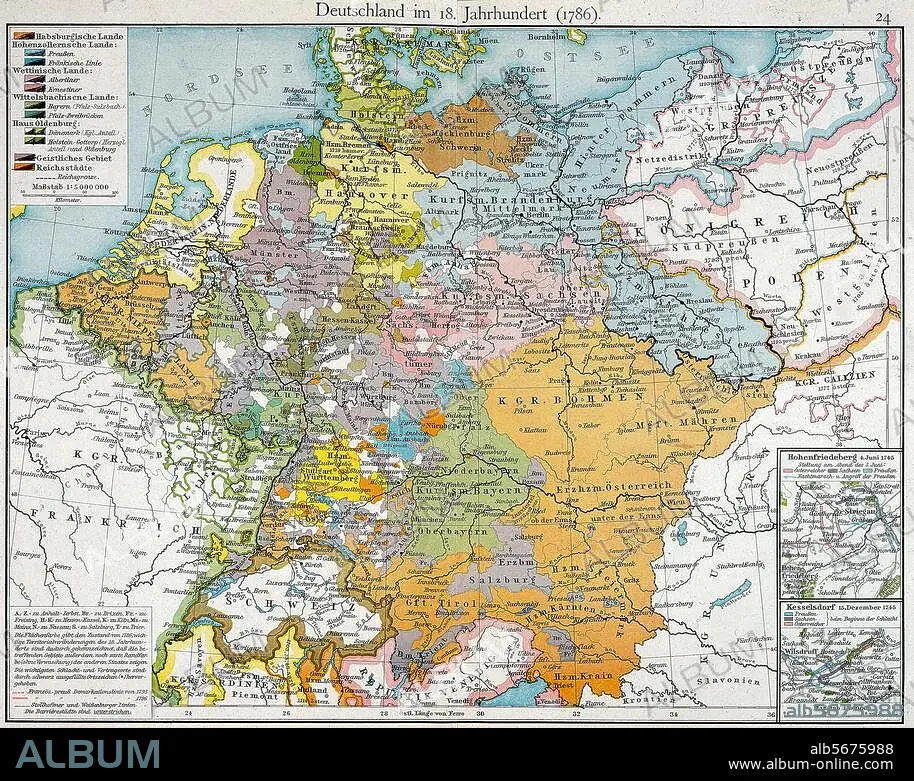
Title:
Germany in 1786 / Map
Caption:
Germany, maps. Political boundaries in 1786. From: F.W.Putzger, Historischer Schul-Atlas, Bielefeld and Leipzig 1904.
Technique/material:
PRINT (ART)
Credit:
Album / akg-images
Releases:
Model: No - Property: No
Rights questions?
Rights questions?
Image size:
3364 x 2678 px | 25.8 MB
Print size:
28.5 x 22.7 cm | 11.2 x 8.9 in (300 dpi)
Keywords:
