alb3549693
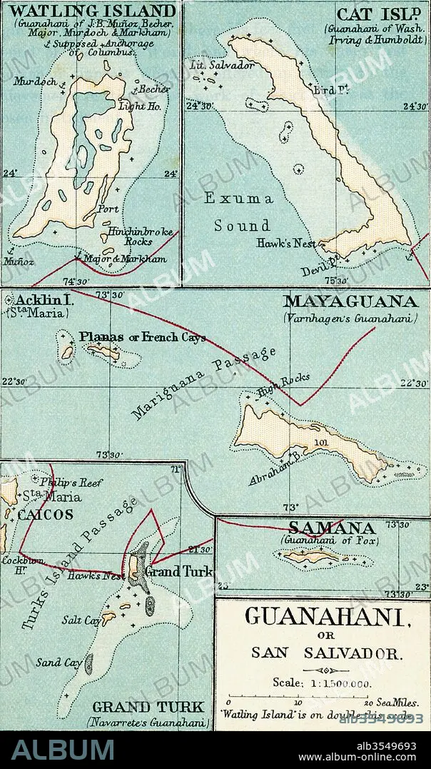
Map of Guanahani or San Salvador showing Watling Island where Christopher Columbus made landfall in 1492
| Share |
|---|
 Pinterest Pinterest |
 Twitter Twitter |
 Facebook Facebook |
 Copy link Copy link |
 Email Email |
|
Add to another lightbox |
|
Add to another lightbox |


Title:
Map of Guanahani or San Salvador showing Watling Island where Christopher Columbus made landfall in 1492
Caption:
Map of Guanahani or San Salvador showing Watling Island where Christopher Columbus made landfall in 1492. From the book Life of Christopher Columbus by Clements R. Markham published 1892.
Credit:
Album / Universal Images Group / Universal History Archive
Releases:
Model: No - Property: No
Rights questions?
Rights questions?
Image size:
3220 x 5457 px | 50.3 MB
Print size:
27.3 x 46.2 cm | 10.7 x 18.2 in (300 dpi)
Keywords:
1492 • ANIMAL: CAT • BAHAMAS • CAICOS • CARTOGRAPHY • CAT • CHART • CHRISTOPHER • COLON • COLUMBUS • CRISTÓBAL • CRISTOVAL • FELIS CATUS • GEOGRAPHICAL • GEOGRAPHY • GRAND • GUANAHANI • ISLAND • LANDFALL • MAP MAKING • MAP • MAPMAKING • MAYAGUANA • NEW • PLAN (CARTOGRAPHY) • SALVADOR • SAMANA • SAN • TURKISH • WATLING • WORLD
