alb4519187
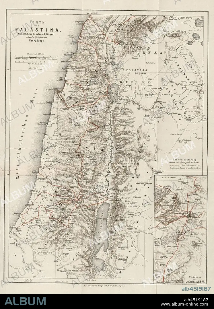
Map of Palestine and surrounding area of Jerusalem, Map of Palestine, Fig. 2, after p. 414, Velde, Charles William Meredith van de (inv.); Kiepert, Heinrich (inv.); Lange, Henry (del.); F. A. Brockhaus' Geogr. artist. Anstalt (ed.), 1865, Konrad Furrer: Wanderungen durch Palästina. Zürich: Orell Füssli, 1865.
| Share |
|---|
 Pinterest Pinterest |
 Twitter Twitter |
 Facebook Facebook |
 Copy link Copy link |
 Email Email |
|
Add to another lightbox |
|
Add to another lightbox |


Caption:
Map of Palestine and surrounding area of Jerusalem, Map of Palestine, Fig. 2, after p. 414, Velde, Charles William Meredith van de (inv.); Kiepert, Heinrich (inv.); Lange, Henry (del.); F. A. Brockhaus' Geogr. artist. Anstalt (ed.), 1865, Konrad Furrer: Wanderungen durch Palästina. Zürich: Orell Füssli, 1865
Personalities:
Credit:
Album / quintlox
Releases:
Model: No - Property: No
Rights questions?
Rights questions?
Image size:
3035 x 4168 px | 36.2 MB
Print size:
25.7 x 35.3 cm | 10.1 x 13.9 in (300 dpi)
Keywords:
1865 • CHARLES WILLIAM MEREDITH VAN DE • DEL. • ÉD. • F. A. BROCKHAUS' GEOGR. ARTIST. ANSTALT • FIG. 2 • HEINRICH • HENRY • INV. • JERUSALEM • KIEPERT • KONRAD FURRER • LANGE • MAP • ORELL FÜSSLI • P. 414 • PALESTINAN • PALESTINE • PLAN (CARTOGRAPHY) • SURROUNDING AREA • VELDE • WANDERUNGEN DURCH PALÄSTINA • ZÜRICH
