alb4076076
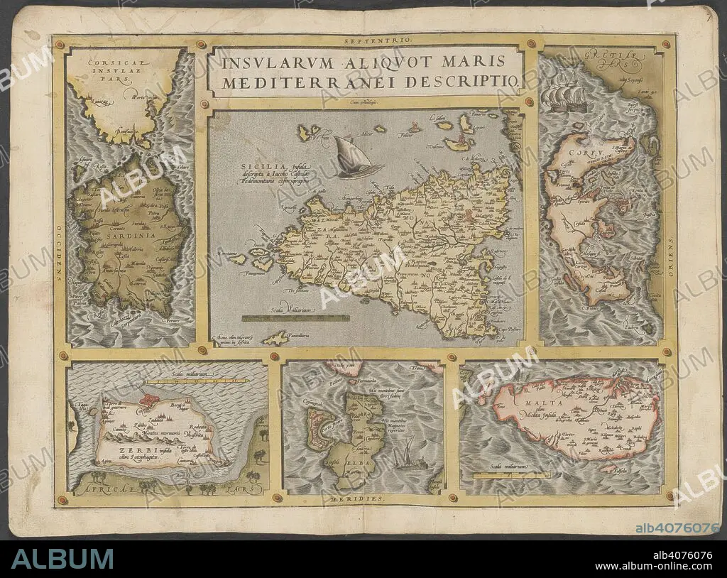
Mediterranean islands. The Mercator atlas of Europe. 1570-1572. Maps of Corsica, Sardinia, Sicily, Corfu, Elba and Malta. Image taken from The Mercator atlas of Europe. Originally published/produced in 1570-1572. . Source: Maps.C.29.c.13, 21.
| Share |
|---|
 Pinterest Pinterest |
 Twitter Twitter |
 Facebook Facebook |
 Copy link Copy link |
 Email Email |
|
Add to another lightbox |
|
Add to another lightbox |


Caption:
Mediterranean islands. The Mercator atlas of Europe. 1570-1572. Maps of Corsica, Sardinia, Sicily, Corfu, Elba and Malta. Image taken from The Mercator atlas of Europe. Originally published/produced in 1570-1572. . Source: Maps.C.29.c.13, 21.
Credit:
Album / British Library
Releases:
Model: No - Property: No
Rights questions?
Rights questions?
Image size:
9589 x 7128 px | 195.6 MB
Print size:
81.2 x 60.4 cm | 32.0 x 23.8 in (300 dpi)
Keywords:
CARTE • CARTOGRAPHY • CORFU • CORSICA • ELBA • EUROPE • IONIAN SEA • ITALIA • ITALY • MALTA • MAP MAKING • MAP • MEDITERRANEAN SEA • MEDITERRANEAN • PLAN (CARTOGRAPHY) • SICILY • SOUTHERN EUROPE • TUSCAN • TUSCANY • WESTERN EUROPE
