alb5584520
WALTER TRIER. Europe in 1914 / Satirical Map.
| Share |
|---|
 Pinterest Pinterest |
 Twitter Twitter |
 Facebook Facebook |
 Copy link Copy link |
 Email Email |
|
Add to another lightbox |
|
Add to another lightbox |


Author:
Title:
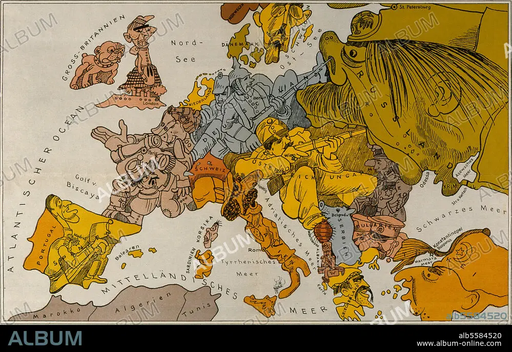
Europe in 1914 / Satirical Map.
Caption:
First World War: Maps. - "Karte von Europa im Jahre 1914". (Map of Europe 1914.) - Map by W. Trier (1890-1951), satirizing political and military situation in Europe at the outbreak of World War I.
Technique/material:
GRAPHIC ART
Location:
EUROPE
Credit:
Album / akg-images
Releases:
Model: No - Property: No
Rights questions?
Rights questions?
Image size:
4961 x 3147 px | 44.7 MB
Print size:
42.0 x 26.6 cm | 16.5 x 10.5 in (300 dpi)
Keywords:
1910S • 1ST WORLD WAR • 20 XX TWENTIETH CENTURY • 20TH CENTURY • 2ND MILLENNIUM A. D. • ANTI-WAR ART • ART • ARTS • EUROPE • FIRST WORLD WAR • GERMANY • GRAPHIC ART • GRAPHIC ARTS • HISTORIA UNIVERSAL • HISTORY AND POLITICS • HISTORY • HUNDRED YEARS WAR • LEGEND • MAP • PLAN (CARTOGRAPHY) • RED CROSS • SATIRE • SATIRICAL WORK • TWENTIETH CENTURY • WALTER TRIER • WAR • WORLD WAR I (1914-18) • WORLD WAR I • WWI
